grüner Tropfen
grüner Tropfen is a work of art in Güssing, Burgenland. grüner Tropfen is situated nearby to Auswanderermuseum/Josef Reichl Museum, as well as near the shopping center WIM Center.| Tap on a place to explore it |
- Type: Work of art
- Artwork type: sculpture
- Also known as: “Tropfensymbol”
- Wheelchair access: limited
Places of Interest Nearby
Highlights include Güssing Castle and Klosterkirche – Franziskanerkloster – Familiengruft der Batthyány.
Güssing Castle
Castle

Photo: Bwag, CC BY-SA 3.0 at.
Güssing Castle is a castle in southern Burgenland, Austria. On June 30, 1524, the castle was acquired by the Batthyány family, which retains ownership through a historical foundation that provides for the care and maintenance of the castle. Güssing Castle is situated 660 metres southwest of grüner Tropfen.
Klosterkirche – Franziskanerkloster – Familiengruft der Batthyány
Church
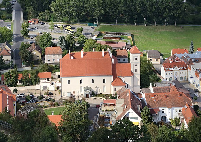
Photo: Bwag, CC BY-SA 3.0 at.
Klosterkirche – Franziskanerkloster – Familiengruft der Batthyány is a church, which is situated 400 metres southwest of grüner Tropfen.
Schloss Draskovich
Castle

Photo: Bwag, CC BY-SA 3.0 at.
Schloss Draskovich is a castle, which is situated 500 metres south of grüner Tropfen.
Places in the Area
Nearby places include Sankt Nikolaus and Gerersdorf bei Güssing.

Gerersdorf bei Güssing
Village

Photo: Bwag, CC BY-SA 4.0.
Gerersdorf bei Güssing is a village, which is situated 5 km west of grüner Tropfen.
Rehgraben
Village
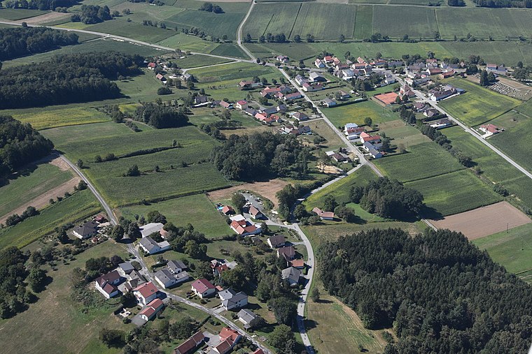
Photo: Iswoar, CC BY-SA 3.0.
Rehgraben is a village, which is situated 7 km west of grüner Tropfen.
grüner Tropfen
- Category: tourism
- Location: Güssing, Güssing District, Burgenland, Austria, Central Europe, Europe
- View on OpenStreetMap
Latitude
47.06224° or 47° 3′ 44″ northLongitude
16.32727° or 16° 19′ 38″ eastOpen location code
8FVR386G+VWOpenStreetMap ID
node 3468232459OpenStreetMap feature
tourism=artworkOpenStreetMap attribute
artwork_type=sculptureOpenStreetMap attribute
wheelchair=limited
This page is based on OpenStreetMap, Wikidata, and Wikimedia Commons.
We’d love your help improving our open data sources. Thank you for contributing.
Satellite Map
Discover grüner Tropfen from above in high-definition satellite imagery.
Notable Places Nearby
Highlights include Auswanderermuseum/Josef Reichl Museum and WIM Center.
Nearby Places
Explore places such as Öko Energie and Feel it.
Burgenland: Must-Visit Destinations
Delve into Eisenstadt, Neusiedl am See, and Rust.
Curious Work Of Arts to Discover
Uncover intriguing work of arts from every corner of the globe.
About Mapcarta. Data © OpenStreetMap contributors and available under the Open Database License". Text is available under the CC BY-SA 4.0 license, except for photos, directions, and the map. Photo: Ueb-at, CC BY-SA 3.0.