Römische Ausgrabung
Römische Ausgrabung is an archaeological site in Wattens, Innsbruck-Land District, Tyrol. Römische Ausgrabung is situated nearby to Swarovski Kristallwelten, as well as near the tourism office Ticket Office.| Tap on a place to explore it |
Places of Interest Nearby
Highlights include Swarovski Kristallwelten and Christuskirche, Wattens.
Swarovski Kristallwelten

Photo: Gegengoliath, Public domain.
Swarovski Kristallwelten is an experience attraction created by André Heller for the crystal glass manufacturer Swarovski, consisting of a park, art museum, retail area, and restaurant.
Christuskirche, Wattens
Church
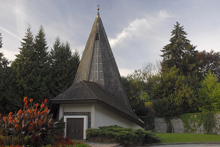
Photo: Haneburger, Public domain.
Christuskirche, Wattens is a church, which is situated 460 metres southwest of Römische Ausgrabung.
Museum Wattens
Museum

Photo: Stefan Fadinger, CC BY-SA 4.0.
Museum Wattens is situated 760 metres southwest of Römische Ausgrabung.
Places in the Area
Nearby places include Fritzens and Wattenberg.
Fritzens
Village

Photo: HellasX, CC BY-SA 2.5.
Fritzens is a municipality in the district Innsbruck country in Tyrol. It lies 16 km east of Innsbruck on the north side of the Inn River. The Iron Age Fritzens-Sanzeno culture is named for archaeological finds from the village.
Wattenberg
Village

Photo: HellasX, CC BY-SA 2.5.
Wattenberg is a municipality in the district of Innsbruck-Land in the Austrian state of Tyrol located 15 km east of Innsbruck and 2.50 km above the Swarovski crystal town Wattens. Wattenberg is situated 2½ km south of Römische Ausgrabung.
Kolsass
Village

Photo: Haneburger, Public domain.
Kolsass is a municipality in the district Innsbruck-Land in the Austrian state of Tyrol located about 17 km east of Innsbruck. The location was first mentioned as „Quolesazz or Cholsasz" in 1050. Kolsass is situated 2½ km east of Römische Ausgrabung.
Römische Ausgrabung
- Type: Archaeological site
- Categories: historic site, tourist attraction, and tourism
- Location: Wattens, Innsbruck-Land District, Tyrol, Austria, Central Europe, Europe
- View on OpenStreetMap
Latitude
47.29465° or 47° 17′ 41″ northLongitude
11.60147° or 11° 36′ 5″ eastOpen location code
8FVH7JV2+VHOpenStreetMap ID
node 3485363273OpenStreetMap feature
historic=archaeological_site
This page is based on OpenStreetMap, Wikidata, and Wikimedia Commons.
We’d love your help improving our open data sources. Thank you for contributing.
Satellite Map
Discover Römische Ausgrabung from above in high-definition satellite imagery.
Places with the Same Name
Discover other places named “Römische Ausgrabung”.
Notable Places Nearby
Highlights include Ticket Office and Swarovski Fountain.
Nearby Places
Explore places such as Conveyor-Belt and Fire - Water - Earth - Air.
Tyrol: Must-Visit Destinations
Delve into Innsbruck, Kufstein, Lienz, and Kitzbühel.
Curious Archaeological Sites to Discover
Uncover intriguing archaeological sites from every corner of the globe.
About Mapcarta. Data © OpenStreetMap contributors and available under the Open Database License". Text is available under the CC BY-SA 4.0 license, except for photos, directions, and the map. Photo: Traveler100, CC BY-SA 3.0.