Knocknabinny
Knocknabinny is a locality in County Cork, Munster. Knocknabinny is situated nearby to the locality Barrel Cross Roads, as well as near Pikesland.| Tap on a place to explore it |
Places of Interest
Highlights include Desmond Castle and Church of St Multose.
Desmond Castle
Museum
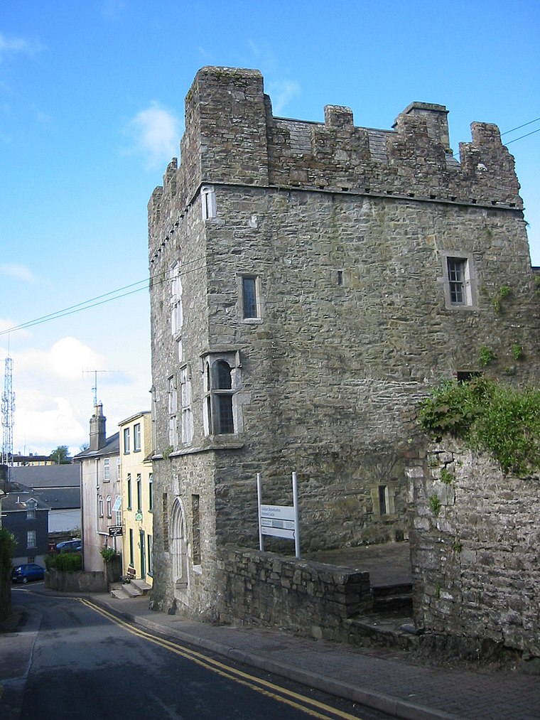
Photo: Wikimedia, CC BY-SA 3.0.
Desmond Castle is a tower house located in the town of Kinsale in County Cork, Ireland. Desmond Castle is situated 4 km northeast of Knocknabinny.
Church of St Multose
Church

Photo: Jonjobaker, CC BY-SA 4.0.
The Church of St Multose is a Church of Ireland church located in Kinsale in Ireland. It is a cruciform church with a crypt. The current structure dates from the 1190s up to major additions in the 1750s with further renovations into the twentieth century. Church of St Multose is situated 3½ km northeast of Knocknabinny.
Sandycove Island
Islet

Photo: Andy Beecroft, CC BY-SA 2.0.
Sandycove Island is a small island and townland at the mouth of Ardkilly Creek on the south coast of Ireland, just to the west of the Castlepark peninsula, which forms the western side of the entrance to Kinsale harbour in County Cork. Sandycove Island is situated 3½ km east of Knocknabinny.
Places in the Area
Nearby places include Ballinspittle and Kinsale.
Ballinspittle
Village

Photo: Richard Webb, CC BY-SA 2.0.
Ballinspittle is a village in County Cork, Ireland. It is in the barony of Courceys and lies about 8 km southwest of Kinsale, on the R600 road. It is near Garrylucas and Garrettstown Blue Flag beaches. Ballinspittle is situated 3 km southwest of Knocknabinny.
Kinsale

Photo: Christopher Michel, CC BY 2.0.
Kinsale is a small harbour in County Cork, Southwest Ireland. It's 25 km south of Cork city, at the mouth of the River Bandon, and in 2022 had a population of 6000.
Dunderrow
Locality
Dunderrow is a small village in County Cork, Ireland. It is 5 km north-west of Kinsale, on the R605 road between Kinsale and Innishannon. Dún Darú, anglicised as Dunderrow, means the fort of the oak-plain, with the site of the fort for which it is named located to the south of the village. Dunderrow is situated 5 km north of Knocknabinny.
Knocknabinny
- Type: Locality
- Location: County Cork, Munster, Southwest Ireland, Ireland, Britain and Ireland, Europe
- View on OpenStreetMap
Latitude
51.68769° or 51° 41′ 16″ northLongitude
-8.5693° or 8° 34′ 10″ westOpen location code
9C3HMCQJ+37OpenStreetMap ID
node 3517877165OpenStreetMap feature
place=locality
This page is based on OpenStreetMap, Wikidata, and Wikimedia Commons.
We’d love your help improving our open data sources. Thank you for contributing.
Satellite Map
Discover Knocknabinny from above in high-definition satellite imagery.
Localities in the Area
Explore places such as Barrel Cross Roads and Pikesland.
Notable Places Nearby
Highlights include The Brake Glen and Babe’s Glen.
County Cork: Must-Visit Destinations
Delve into Cork, Cobh, Kinsale, and Mallow.
Curious Localities to Discover
Uncover intriguing localities from every corner of the globe.
About Mapcarta. Data © OpenStreetMap contributors and available under the Open Database License". Text is available under the CC BY-SA 4.0 license, except for photos, directions, and the map. Photo: Wikimedia, CC BY-SA 3.0.