Mitchelstown East
Mitchelstown East is a locality in County Cork, Munster. Mitchelstown East is situated nearby to the locality Ballinrichard, as well as near Mitchelstown West.| Tap on a place to explore it |
Places of Interest
Highlights include Desmond Castle and Charles Fort.
Desmond Castle
Museum
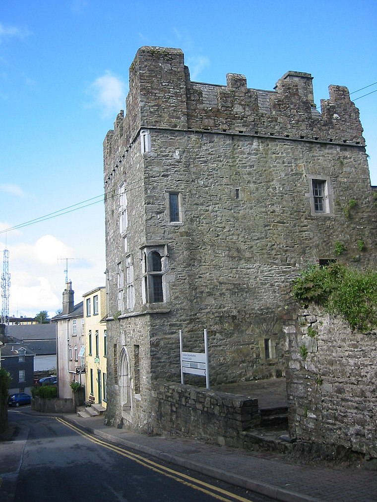
Photo: Wikimedia, CC BY-SA 3.0.
Desmond Castle is a tower house located in the town of Kinsale in County Cork, Ireland. Desmond Castle is situated 3 km southwest of Mitchelstown East.
Charles Fort

Photo: The Speckled Bird, CC BY-SA 4.0.
Charles Fort is a trace italienne fortification, a bastion fort with one section of the outer wall built in star fashion. It is located at the southern end of the village of Summer Cove, on Kinsale harbour, County Cork, Ireland. Charles Fort is situated 3½ km south of Mitchelstown East.
James‘ Fort
Archaeological site

Photo: The Speckled Bird, CC BY-SA 4.0.
James Fort is an early 17th-century pentagonal bastion fort located on Castlepark peninsula in Kinsale harbour, County Cork, Ireland. Situated downstream from Kinsale on the River Bandon, the fort was built to defend the harbour and seaborne approaches of the town. James‘ Fort is situated 3½ km south of Mitchelstown East.
Places in the Area
Nearby places include Belgooly and Kinsale.
Belgooly
Village

Photo: Neville Goodman, CC BY-SA 2.0.
Belgooly (Irish: Béal Guala is a village in County Cork, Ireland, located 4.6 kilometres to the north-east of Kinsale. In 2022 it had a population of 823.
Kinsale

Photo: Christopher Michel, CC BY 2.0.
Kinsale is a small harbour in County Cork, Southwest Ireland. It's 25 km south of Cork city, at the mouth of the River Bandon, and in 2022 had a population of 6000.
Summer Cove
Locality

Photo: David Hawgood, CC BY-SA 2.0.
Summer Cove is part of Kinsale town on the Kinsale harbour, on the south coast of Ireland; it faces westwards across the entrance of the harbour to the Castlepark peninsula. Summer Cove is situated 3 km south of Mitchelstown East.
Mitchelstown East
- Type: Locality
- Location: County Cork, Munster, Southwest Ireland, Ireland, Britain and Ireland, Europe
- View on OpenStreetMap
Latitude
51.72872° or 51° 43′ 43″ northLongitude
-8.49655° or 8° 29′ 48″ westOpen location code
9C3HPGH3+F9OpenStreetMap ID
node 3524287789OpenStreetMap feature
place=locality
This page is based on OpenStreetMap, Wikidata, and Wikimedia Commons.
We’d love your help improving our open data sources. Thank you for contributing.
Satellite Map
Discover Mitchelstown East from above in high-definition satellite imagery.
Localities in the Area
Explore places such as Ballinrichard and Mitchelstown West.
Notable Places Nearby
Highlights include Pallastown Wood and Belgooly G.A.A. Club.
County Cork: Must-Visit Destinations
Delve into Cork, Cobh, Kinsale, and Mallow.
Curious Localities to Discover
Uncover intriguing localities from every corner of the globe.
About Mapcarta. Data © OpenStreetMap contributors and available under the Open Database License". Text is available under the CC BY-SA 4.0 license, except for photos, directions, and the map. Photo: Wikimedia, CC BY-SA 3.0.