International Hot Tubs
International Hot Tubs is an office in City and County of Denver, Colorado which is located on Zuni Street. International Hot Tubs is situated nearby to the sports venue Shape Plus Personal Training, as well as near the art gallery Donigan Artworks.| Tap on a place to explore it |
Places of Interest Nearby
Highlights include Ball Arena and Decatur–Federal station.
Ball Arena
Stadium
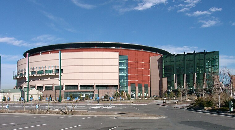
Photo: Wikimedia, CC BY-SA 2.5.
Ball Arena is a multi-purpose indoor arena located in Denver, Colorado, United States. It is situated at Speer Boulevard, a main thoroughfare in downtown Denver, and is served by two nearby exits off Interstate 25. Ball Arena is situated 1¼ miles northeast of International Hot Tubs.
Decatur–Federal station
Railway station

Photo: Denverjeffrey, CC BY 3.0.
Decatur–Federal station is an at-grade light rail station on the W Line of the RTD Rail system. It is located alongside the banks of the Lakewood Gulch between its intersections with Decatur Street and Federal Boulevard, after which the station is named, in Denver, Colorado. Decatur–Federal station is situated 2,600 feet northwest of International Hot Tubs.
10th & Osage station
Railway station

Photo: Denverjeffrey, CC BY-SA 3.0.
10th & Osage station is a RTD light rail station in Denver, Colorado, United States. Operating as part of the D, E and H Lines, the station was opened on October 8, 1994, and is operated by the Regional Transportation District. 10th & Osage station is situated 3,100 feet east of International Hot Tubs.
Places in the Area
Nearby places include Sun Valley and Valverde.
Sun Valley
Neighborhood

Photo: Denverjeffrey, CC BY 3.0.
Sun Valley is a neighborhood in central Denver, Colorado, bordered by I-25 on the east, Federal Blvd. on the west, 6th Avenue on the south and 20th Ave. on the north. It is located in the area known as West Denver.
Valverde
Neighborhood

Photo: Denverjeffrey, CC BY-SA 3.0.
Valverde is a neighborhood of Denver, Colorado. It is in the area known as West Denver or the "West Side". According to the Piton Foundation, in 2007, the population of the neighborhood was 4,093, and there were 1,276 housing units.
Auraria
Neighborhood

Photo: Denverjeffrey, CC BY-SA 3.0.
Auraria was a gold mining camp established in 1858 in the Kansas Territory of the United States. Today it survives in its original location as a neighborhood of Denver, Colorado, immediately south of the confluence of Cherry Creek and the South Platte River.
International Hot Tubs
- Type: Business
- Address: 1035 Zuni Street, Denver, CO 80204
- Category: office
- Location: City and County of Denver, Colorado, Rocky Mountains, United States, North America
- View on OpenStreetMap
Latitude
39.73281° or 39° 43′ 58″ northLongitude
-105.01659° or 105° 0′ 60″ westOpen location code
85FPPXMM+49OpenStreetMap ID
node 3528304824OpenStreetMap feature
office=company
This page is based on OpenStreetMap, Wikidata, and Wikimedia Commons.
We’d love your help improving our open data sources. Thank you for contributing.
Satellite Map
Discover International Hot Tubs from above in high-definition satellite imagery.
Places with the Same Name
Discover other places named “International Hot Tubs”.
Notable Places Nearby
Highlights include Shape Plus Personal Training and Donigan Artworks.
Nearby Places
Explore places such as Ultra Design Center Kitchen & Bath and A&E Roofing Services.
Colorado: Must-Visit Destinations
Delve into Denver, Colorado Springs, Boulder, and Aurora.
Curious Places to Discover
Uncover intriguing places from every corner of the globe.
About Mapcarta. Data © OpenStreetMap contributors and available under the Open Database License". Text is available under the CC BY-SA 4.0 license, except for photos, directions, and the map. Photo: mark gallagher, CC BY 2.0.