Curraghgrane Beg
Curraghgrane Beg is a locality in County Cork, Munster. Curraghgrane Beg is situated nearby to the locality North Ring, as well as near Curraghgrane More.| Tap on a place to explore it |
Places of Interest
Highlights include Lios na gCon and Clonakilty Library.
Lios na gCon
Archaeological site
Lios na gCon is a reconstructed ringfort located in Darrara, County Cork, Ireland. It was excavated and reconstructed on its original location between August 1987 and August 1989 by Macra na Feirme from Clonakilty.
Clonakilty Library
Library
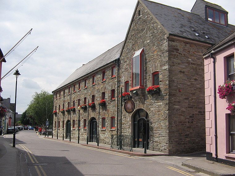
Photo: Chmee2, CC BY-SA 3.0.
Clonakilty Library is situated 2½ km west of Curraghgrane Beg.
Templebryan Stone Circle
Archaeological site

Photo: Ceoil, CC BY-SA 3.0.
Templebryan Stone Circle is a stone circle, located 2.5 km north of Clonakilty, County Cork, Ireland. Grid ref: W386 438. Close by lies an Early Christian site. Templebryan Stone Circle is situated 3½ km northwest of Curraghgrane Beg.
Places in the Area
Nearby places include Clonakilty and Shannonvale.
Clonakilty

Photo: Wikimedia, CC BY-SA 3.0.
Clonakilty, often shortened to "Clon", is a town on the coast of County Cork in southwest Ireland, 50 km southwest of Cork city. It's a seaside resort, with a population of 5000 in 2022.
Shannonvale
Village
Shannonvale or Shannon Vale is a small rural village near Clonakilty in County Cork, Ireland. It lies in the civil parishes of Kilnagross and Templebryan. Shannonvale is situated 4 km northwest of Curraghgrane Beg.
Ballinascarty
Village
Photo: Mike Searle, CC BY-SA 2.0.
Ballinascarty, also known as Ballinascarthy, is a village in County Cork, Ireland. Ballinascarty is situated 6 km north of Curraghgrane Beg.
Curraghgrane Beg
- Type: Locality
- Location: County Cork, Munster, Southwest Ireland, Ireland, Britain and Ireland, Europe
- View on OpenStreetMap
Latitude
51.61706° or 51° 37′ 1″ northLongitude
-8.8511° or 8° 51′ 4″ westOpen location code
9C3HJ48X+RHOpenStreetMap ID
node 3539501322OpenStreetMap feature
place=locality
This page is based on OpenStreetMap, Wikidata, and Wikimedia Commons.
We’d love your help improving our open data sources. Thank you for contributing.
Satellite Map
Discover Curraghgrane Beg from above in high-definition satellite imagery.
Localities in the Area
Explore places such as North Ring and Curraghgrane More.
Notable Places Nearby
Highlights include Arundel Grain Store and Ballintemple Graveyard.
County Cork: Must-Visit Destinations
Delve into Cork, Cobh, Kinsale, and Mallow.
Curious Localities to Discover
Uncover intriguing localities from every corner of the globe.
About Mapcarta. Data © OpenStreetMap contributors and available under the Open Database License". Text is available under the CC BY-SA 4.0 license, except for photos, directions, and the map. Photo: Wikimedia, CC BY-SA 3.0.