Branderin torppa
Branderin torppa is a museum in Nokia, Tampere, Pirkanmaa. Branderin torppa is situated nearby to the forest Lehtimäenpuisto I, as well as near Kisalavanpuisto.| Tap on a place to explore it |
Places of Interest Nearby
Highlights include Nokia Church and Nokia railway station.
Nokia Church
Church

Photo: Wikimedia, CC BY-SA 3.0.
The Nokia Church is a 19th-century stone church located in Nokia town in Pirkanmaa, Finland. The Neoclassical church building was designed by C. L. Engel, and it was completed in 1837. Nokia Church is situated 1¼ km southwest of Branderin torppa.
Nokia railway station
Railway station
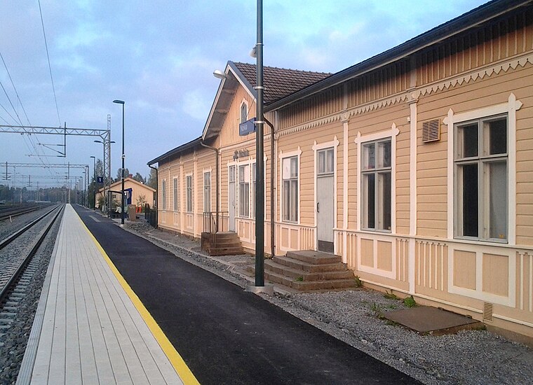
Photo: Junafani, CC BY-SA 4.0.
The Nokia railway station is located in the town of Nokia, Finland, on the Tampere–Pori railway. Trains between Tampere and Pori stop there twelve times a day, half of which in each direction. Nokia railway station is situated 2½ km southwest of Branderin torppa.
Pitkäniemi Hospital
Hospital

Photo: PtG, CC BY-SA 3.0.
Pitkäniemi Hospital is situated 2½ km southeast of Branderin torppa.
Places in the Area
Nearby places include Kalkku and Myllypuro.
Kalkku
Suburb

Photo: Harri Hedman, CC BY 3.0.
Kalkku is a suburb, which is situated 2½ km east of Branderin torppa.
Myllypuro
Suburb

Photo: PtG, CC BY-SA 3.0.
Myllypuro is a neighbourhood in the city of Tampere, Finland near border of the Nokia municipality. It got its name from the Myllypuro flowing between the district and Ikuri, whose old name is Tuohijoki or also Myllyoja. Myllypuro is situated 2½ km northeast of Branderin torppa.
Ikuri
Suburb

Photo: PtG, CC BY-SA 3.0.
Ikuri is one of the westernmost districts of Tampere, Finland, near the border of Nokia. The streets in the district have been named in a rural fashion, such as Maamiehentie, Heinämiehentie and Marjamiehentie. Ikuri is situated 4 km northeast of Branderin torppa.
Branderin torppa
- Type: Museum
- Categories: tourism and tourist attraction
- Location: Nokia, Tampere, Pirkanmaa, Finnish Lakeland, Finland, Nordic countries, Europe
- View on OpenStreetMap
Latitude
61.48958° or 61° 29′ 23″ northLongitude
23.54178° or 23° 32′ 30″ eastOpen location code
9GH5FGQR+RPOpenStreetMap ID
node 3565346093OpenStreetMap feature
tourism=museum
This page is based on OpenStreetMap, Wikidata, and Wikimedia Commons.
We’d love your help improving our open data sources. Thank you for contributing.
Satellite Map
Discover Branderin torppa from above in high-definition satellite imagery.
Notable Places Nearby
Highlights include Lehtimäenpuisto I and Kisalavanpuisto.
Nearby Places
Explore places such as Vihnukselan lastenkoti and Autohuolto.com Nokia.
Pirkanmaa: Must-Visit Destinations
Delve into Tampere, Valkeakoski, Akaa, and Ylöjärvi.
Curious Museums to Discover
Uncover intriguing museums from every corner of the globe.
About Mapcarta. Data © OpenStreetMap contributors and available under the Open Database License". Text is available under the CC BY-SA 4.0 license, except for photos, directions, and the map. Photo: Harri Hedman, CC BY 3.0.