Szepkreuz
Szepkreuz is a wayside cross in Rechnitz, Oberwart District, Burgenland. Szepkreuz is situated nearby to the cave Sinterspalte, as well as near the peak Salzriegel.| Tap on a place to explore it |
Places of Interest Nearby
Highlights include Írott-kő and Watch tower Írott-kő.
Írott-kő
Peak

Photo: Bwag, CC BY-SA 4.0.
The Geschriebenstein, less commonly called the Írott-kő in English sources, is a mountain, 884 metres high, located on the border between Austria and Hungary.
Watch tower Írott-kő
Scenic viewpoint

Photo: Bwag, CC BY-SA 4.0.
Watch tower Írott-kő is a scenic viewpoint, which is situated 2 km southeast of Szepkreuz.
Großer Hirschenstein
Scenic viewpoint

Photo: Pan Peter12, CC BY-SA 4.0.
Großer Hirschenstein is a scenic viewpoint, which is situated 4 km southwest of Szepkreuz.
Places in the Area
Nearby places include Steier Houses and Hammerteich.
Steier Houses
Locality

Photo: VargaA, CC BY-SA 4.0.
Steier Houses is a locality, which is situated 4 km east of Szepkreuz.
Hammerteich
Village
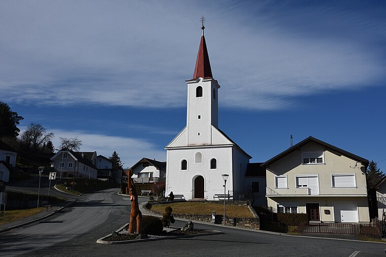
Photo: Iswoar, CC BY-SA 4.0.
Hammerteich is a village, which is situated 5 km north of Szepkreuz.
Oberkohlstätten
Village

Photo: Haeferl, CC BY-SA 4.0.
Oberkohlstätten is a village, which is situated 6 km west of Szepkreuz.
Szepkreuz
- Type: Wayside cross
- Category: historic site
- Location: Rechnitz, Oberwart District, Burgenland, Austria, Central Europe, Europe
- View on OpenStreetMap
Latitude
47.3685° or 47° 22′ 7″ northLongitude
16.41742° or 16° 25′ 3″ eastOpen location code
8FVR9C98+9XOpenStreetMap ID
node 3595902597OpenStreetMap feature
historic=wayside_cross
This page is based on OpenStreetMap, Wikidata, and Wikimedia Commons.
We’d love your help improving our open data sources. Thank you for contributing.
Satellite Map
Discover Szepkreuz from above in high-definition satellite imagery.
Notable Places Nearby
Highlights include Sinterspalte and Salzriegel.
Nearby Places
Explore places such as Geschriebenstein Kalköfen and Wasser Verb. Bstl..
Burgenland: Must-Visit Destinations
Delve into Eisenstadt, Neusiedl am See, Rust, and Güssing.
Curious Wayside Crosses to Discover
Uncover intriguing wayside crosses from every corner of the globe.
About Mapcarta. Data © OpenStreetMap contributors and available under the Open Database License". Text is available under the CC BY-SA 4.0 license, except for photos, directions, and the map. Photo: Wikimedia, CC BY-SA 4.0.