Mattheiser Turm
Mattheiser Turm is a tower in Villmar, Limburg-Weilburg, Hesse. Mattheiser Turm is situated nearby to the town hall Rathaus, as well as near the public building Bauamt/Schiedsamt.| Tap on a place to explore it |
Places of Interest Nearby
Highlights include Mattheiser Turm and St. Peter und Paul.

St. Peter und Paul
Church

Photo: Mr.Nutt, CC BY-SA 3.0.
St. Peter und Paul is a church, which is situated 350 metres northwest of Mattheiser Turm.
Lahn-Marmor-Museum
Museum
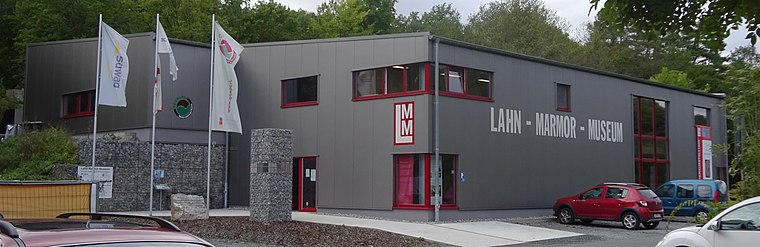
Photo: Christof Ellger, CC BY-SA 4.0.
Lahn-Marmor-Museum is situated 1 km northwest of Mattheiser Turm.
Places in the Area
Nearby places include Dauborn and Limburg an der Lahn.
Dauborn
Village

Photo: Hintertaunus, Public domain.
Dauborn is a village, which is situated 7 km south of Mattheiser Turm.
Limburg an der Lahn

Photo: Mr.Nutt, CC BY-SA 4.0.
Limburg an der Lahn is in Hesse. The town is famous for its marvellous mediaeval town centre with its timber-framed houses and its Dom.
Mattheiser Turm
- Type: Tower
- Category: historic site
- Location: Villmar, Limburg-Weilburg, Giessen, Hesse, Germany, Central Europe, Europe
- View on OpenStreetMap
Latitude
50.38977° or 50° 23′ 23″ northLongitude
8.19276° or 8° 11′ 34″ eastOpen location code
9F2C95QV+W4OpenStreetMap ID
node 359891252OpenStreetMap feature
historic=tower
This page is based on OpenStreetMap, Wikidata, and Wikimedia Commons.
We’d love your help improving our open data sources. Thank you for contributing.
Satellite Map
Discover Mattheiser Turm from above in high-definition satellite imagery.
Places with the Same Name
Discover other places named “Mattheiser Turm”.
Notable Places Nearby
Highlights include Rathaus and Bauamt/Schiedsamt.
Nearby Places
Explore places such as Gaststätte ‘Nassauer Hof’ and Breitenweg.
Hesse: Must-Visit Destinations
Delve into Frankfurt, Wiesbaden, Darmstadt, and Kassel.
Curious Towers to Discover
Uncover intriguing towers from every corner of the globe.
About Mapcarta. Data © OpenStreetMap contributors and available under the Open Database License". Text is available under the CC BY-SA 4.0 license, except for photos, directions, and the map. Photo: Pedelecs, CC BY-SA 3.0.