Sheldon Avenue
Sheldon Avenue is a bus stop in Etobicoke, Toronto, Ontario. Sheldon Avenue is situated nearby to the motel Stay Inn Hotel Toronto, as well as near Church of the Atonement.| Tap on a place to explore it |
Places of Interest Nearby
Highlights include Sherway Gardens and Long Branch GO Station.
Sherway Gardens
Shopping center
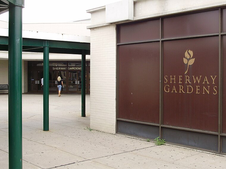
Photo: GTD Aquitaine, Public domain.
Sherway Gardens is a shopping mall in the Etobicoke district of Toronto, Ontario, Canada, near the interchange of Highway 427 with Queen Elizabeth Way and the Gardiner Expressway. Sherway Gardens is situated 1 km west of Sheldon Avenue.
Long Branch GO Station
Railway station

Photo: GTD Aquitaine, Public domain.
Long Branch GO Station is a GO Transit railway station in Toronto, Ontario, Canada. It is one of the Lakeshore West line stations, serving the Long Branch neighbourhood. Long Branch GO Station is situated 2 km south of Sheldon Avenue.
Toronto Golf Club
Golf course

Photo: Kelapstick, CC BY-SA 3.0.
The Toronto Golf Club is a private golf club in Mississauga, Ontario, a suburban municipality to the west of Toronto. Established in Toronto in 1876, it is the third-oldest golf club in North America, after the Royal Montreal Golf Club and the Royal Quebec Golf Club. Toronto Golf Club is situated 2 km south of Sheldon Avenue.
Places in the Area
Nearby places include Alderwood and Long Branch.
Alderwood
Neighborhood

Photo: SimonP, CC BY-SA 3.0.
Alderwood is a neighbourhood in the city of Toronto, Ontario, Canada. It is in the western section of Toronto, within the district of Etobicoke. It is bounded by the Etobicoke Creek to the west, the Gardiner Expressway to the north, the CPR railway to the east and the CNR railway to the south.
Long Branch
Neighborhood

Photo: JosephIWMolto, Public domain.
Long Branch is a neighbourhood and former municipality in the south-west of Toronto, Ontario, Canada. It is located in the south-western corner of the former Township of Etobicoke on the shore of Lake Ontario.
Dixie
Suburb

Photo: GTD Aquitaine, Public domain.
Dixie is a neighbourhood in the city of Mississauga, Ontario, Canada. The community lies in the southeastern part of the city and is one of the older neighbourhoods in the city. Dixie is situated 2½ km west of Sheldon Avenue.
Sheldon Avenue
- Type: Bus stop
- Category: transportation
- Location: Etobicoke, Toronto, Greater Toronto Area, Ontario, Canada, North America
- View on OpenStreetMap
Latitude
43.61157° or 43° 36′ 42″ northLongitude
-79.54574° or 79° 32′ 45″ westOperator
Toronto Transit CommissionOpen location code
87M2JF63+JPOpenStreetMap ID
node 3637363016OpenStreetMap feature
highway=bus_stopOpenStreetMap feature
public_transport=platform
This page is based on OpenStreetMap, Wikidata, and Wikimedia Commons.
We’d love your help improving our open data sources. Thank you for contributing.
Satellite Map
Discover Sheldon Avenue from above in high-definition satellite imagery.
Places with the Same Name
Discover other places named “Sheldon Avenue”.
Notable Places Nearby
Highlights include Stay Inn Hotel Toronto and Church of the Atonement.
Nearby Places
Explore places such as Sheldon Avenue and Active Green + Ross.
Toronto: Must-Visit Destinations
Delve into Yorkville and the Annex, Midtown, East End, and Downtown East.
Curious Bus Stops to Discover
Uncover intriguing bus stops from every corner of the globe.
About Mapcarta. Data © OpenStreetMap contributors and available under the Open Database License". Text is available under the CC BY-SA 4.0 license, except for photos, directions, and the map. Photo: The City of Toronto, CC BY 2.0.