Helenenstraße Schleife
Helenenstraße Schleife is a tram stop in Essen, Düsseldorf, North Rhine-Westphalia. Helenenstraße Schleife is situated nearby to the church St. Mariä Himmelfahrt (Essen), as well as near the police station Wache Nord-West.| Tap on a place to explore it |
Places of Interest Nearby
Highlights include St. Mariä Himmelfahrt (Essen) and Krupp-Park.
St. Mariä Himmelfahrt (Essen)
Church
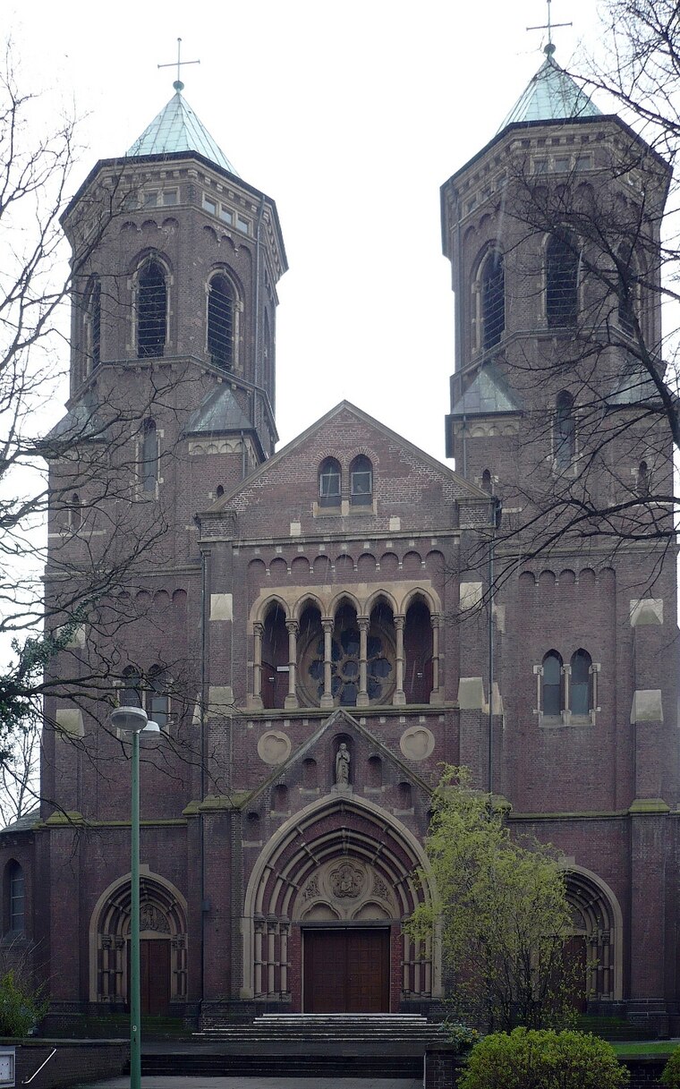
Photo: Wiki05, Public domain.
St. Mariä Himmelfahrt (Essen) is a church.
Krupp-Park
Park

Photo: Wiki05, Public domain.
Krupp-Park is situated 320 metres northeast of Helenenstraße Schleife.
Essen West station
Railway station
 Essen West station is situated in Essen on the Witten/Dortmund–Oberhausen/Duisburg railway in the German state of North Rhine-Westphalia. It is served by lines S1, S3 and S9 of the Rhine-Ruhr S-Bahn. Essen West station is situated 800 metres south of Helenenstraße Schleife.
Places in the Area
Nearby places include Bochold and Borbeck-Mitte.
Bochold
Suburb
Bochold is a northwestern borough of the city of Essen, Germany. It was incorporated into the city in 1915. Before it had been part of the Bürgermeisterei Borbeck.
Borbeck-Mitte
Suburb

Photo: Wikimedia, CC BY-SA 3.0.
Borbeck-Mitte is the central borough of Borbeck, the fourth suburban district of Essen, Germany. Together with the other boroughs of the district, it was incorporated on April 1, 1915. Borbeck-Mitte is situated 2½ km northwest of Helenenstraße Schleife.
Bergeborbeck
Suburb
Bergeborbeck is a northern borough of the city of Essen, Germany, with a population of around 4,400. It was incorporated into the city in 1915, having previously been part of the Bürgermeisterei Borbeck. Bergeborbeck is situated 3 km northwest of Helenenstraße Schleife.
Helenenstraße Schleife
- Type: Tram stop
- Wheelchair access: no
- Categories: railway stop, transport stop, and transportation
- Location: Essen, Düsseldorf, Ruhr, North Rhine-Westphalia, Germany, Central Europe, Europe
- View on OpenStreetMap
Latitude
51.46158° or 51° 27′ 42″ northLongitude
6.98152° or 6° 58′ 54″ eastOperator
RuhrbahnNetwork
Verkehrsverbund Rhein-RuhrOpen location code
9F38FX6J+JJOpenStreetMap ID
node 3644119992OpenStreetMap feature
public_transport=stop_positionOpenStreetMap feature
railway=tram_stopOpenStreetMap attribute
wheelchair=no
This page is based on OpenStreetMap, Wikidata, and Wikimedia Commons.
We’d love your help improving our open data sources. Thank you for contributing.
Satellite Map
Discover Helenenstraße Schleife from above in high-definition satellite imagery.
Notable Places Nearby
Highlights include Wache Nord-West and Gemeindezentrum St. Mariä Himmelfahrt.
Nearby Places
Explore places such as Helenenstr. Schleife and Hochbunker Helenenstraße.
Ruhr: Must-Visit Destinations
Delve into Dortmund, Duisburg, Gelsenkirchen, and Bochum.
Curious Tram Stops to Discover
Uncover intriguing tram stops from every corner of the globe.
About Mapcarta. Data © OpenStreetMap contributors and available under the Open Database License". Text is available under the CC BY-SA 4.0 license, except for photos, directions, and the map. Photo: Tuxyso, CC BY-SA 3.0.