Räber Süd West
Räber Süd West is an electrical substation in Lower Saxony, Germany. Räber Süd West is situated nearby to the nature reserve Lünsholz, as well as near the village Unterlüß.| Tap on a place to explore it |
Places of Interest Nearby
Highlights include Lünsholz and Christuskirche.

Christuskirche
Church

Photo: GregorHelms, CC BY-SA 3.0.
Christuskirche is a church, which is situated 2 km west of Räber Süd West.
Albert-König-Museum
Museum

Photo: Hajotthu, CC BY-SA 3.0.
Albert-König-Museum is situated 2½ km southwest of Räber Süd West.
Places in the Area
Nearby places include Unterlüß and Hösseringen.
Unterlüß
Village
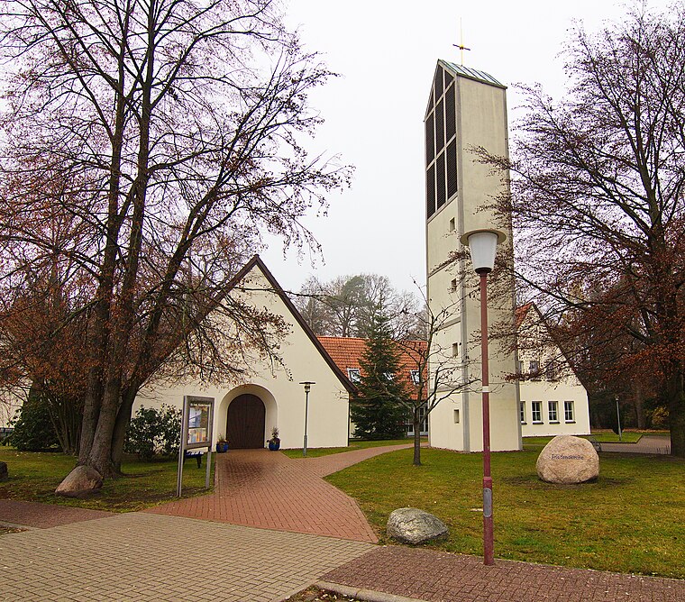
Photo: Losch, CC BY-SA 3.0.
Unterlüß is a village and former municipality in the district of Celle in Lower Saxony, Germany. It became part of the municipality of Südheide on 1 January 2015.
Hösseringen
Village

Photo: Ohndo, CC BY-SA 4.0.
Hösseringen is a village in the collective municipality of Suderburg and lies southwest of Uelzen in the German state of Lower Saxony. Hösseringen is situated 7 km east of Räber Süd West.
Räber Süd West
- Type: Electrical substation
- Category: industry
- Location: Lower Saxony, Germany, Central Europe, Europe
- View on OpenStreetMap
Latitude
52.84744° or 52° 50′ 51″ northLongitude
10.32158° or 10° 19′ 18″ eastOpen location code
9F4GR8WC+XJOpenStreetMap ID
node 365580596
This page is based on OpenStreetMap, Wikidata, and Wikimedia Commons.
We’d love your help improving our open data sources. Thank you for contributing.
Satellite Map
Discover Räber Süd West from above in high-definition satellite imagery.
Notable Places Nearby
Highlights include Dorfplatz and Freiwillige Feuerwehr Unterlüß.
Nearby Places
Explore places such as Rheinmetall Waffe Munition GmbH, Niederlassung Unterlüß and Trafostation 9.
Lower Saxony: Must-Visit Destinations
Delve into Hanover, Göttingen, Brunswick, and Wolfsburg.
Curious Electrical Substations to Discover
Uncover intriguing electrical substations from every corner of the globe.
About Mapcarta. Data © OpenStreetMap contributors and available under the Open Database License". Text is available under the CC BY-SA 4.0 license, except for photos, directions, and the map. Photo: Danapit, CC BY-SA 3.0.