Freie Christengemeinde Hanau
Freie Christengemeinde Hanau is a church in Hanau, Gelnhausen, Hesse which is located on Hindemithstraße. Freie Christengemeinde Hanau is situated nearby to the church Johanneskirche, as well as near the cemetery Friedhof Kesselstadt.| Tap on a place to explore it |
- Email: office@fcg-hanau.de
- Type: Church
- Denomination: Evangelical
- Address: Hindemithstraße 32, Hanau, 63452
Places of Interest Nearby
Highlights include Hanau West and Saint Elisabeth of Hungary Church.
Hanau West
Railway station
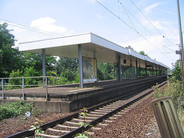
Photo: Wikimedia, CC BY-SA 3.0.
Hanau West station is the oldest station in the city of Hanau in the German state of Hesse. It was opened in 1848 and is located on the 17.9 kilometre mark of the Frankfurt Süd–Aschaffenburg railway. Hanau West is situated 1 km southeast of Freie Christengemeinde Hanau.
Saint Elisabeth of Hungary Church
Church

Photo: Dandelo, CC BY-SA 3.0.
Saint Elisabeth of Hungary Church is situated 1 km southwest of Freie Christengemeinde Hanau.
Philippsruhe Castle

Photo: Milseburg, CC BY-SA 4.0.
Philippsruhe Castle is situated 1½ km south of Freie Christengemeinde Hanau.
Places in the Area
Nearby places include Dietesheim and Wachenbuchen.
Dietesheim
Village

Photo: Offenbacherjung, CC BY-SA 4.0.
Dietesheim is a village, which is situated 3½ km southwest of Freie Christengemeinde Hanau.
Wachenbuchen
Village
Wachenbuchen is the smallest district in the city of Maintal, Hesse, Germany. It is about 17 km east of Frankfurt am Main. Wachenbuchen is situated 4½ km northwest of Freie Christengemeinde Hanau.
Hochstadt
Village
Hochstadt is a district of the city of Maintal in Hesse, Germany. As of 2023, it has a population of 6,202. Hochstadt is situated 5 km west of Freie Christengemeinde Hanau.
Freie Christengemeinde Hanau
- Categories: place of worship and religion
- Location: Hanau, Gelnhausen, South Hesse, Hesse, Germany, Central Europe, Europe
- View on OpenStreetMap
Latitude
50.13992° or 50° 8′ 24″ northLongitude
8.90025° or 8° 54′ 1″ eastOpen location code
9F2C4WQ2+X3OpenStreetMap ID
node 3656285440OpenStreetMap feature
amenity=place_of_worshipOpenStreetMap attribute
denomination=evangelical
This page is based on OpenStreetMap, Wikidata, and Wikimedia Commons.
We’d love your help improving our open data sources. Thank you for contributing.
Satellite Map
Discover Freie Christengemeinde Hanau from above in high-definition satellite imagery.
Notable Places Nearby
Highlights include Johanneskirche and Friedhof Kesselstadt.
Nearby Places
Explore places such as Barmenia Versicherung and Nahkauf Grigorakis GbR.
South Hesse: Must-Visit Destinations
Delve into Darmstadt, Bensheim, Lorsch, and Heppenheim.
Curious Churches to Discover
Uncover intriguing churches from every corner of the globe.
About Mapcarta. Data © OpenStreetMap contributors and available under the Open Database License". Text is available under the CC BY-SA 4.0 license, except for photos, directions, and the map. Photo: Ayhanarfat, CC BY-SA 3.0.