Ermita de la Garganta Verde
Ermita de la Garganta Verde is a cave in Zahara de la Sierra, Cádiz, Andalusia. Ermita de la Garganta Verde is situated nearby to the peak Cerro Cambronero, as well as near the mountain saddle Puerto del Acebuche.| Tap on a place to explore it |
Places of Interest Nearby
Highlights include Iglesia de Santa María de la Mesa (Zahara) and Capilla de San Juan de Letrán (Zahara).
Iglesia de Santa María de la Mesa (Zahara)
Church

Photo: Wikimedia, CC BY-SA 3.0.
Iglesia de Santa María de la Mesa (Zahara) is a church, which is situated 3 km northeast of Ermita de la Garganta Verde.
Capilla de San Juan de Letrán (Zahara)
Church

Photo: Vanbasten 23, CC BY-SA 3.0.
Capilla de San Juan de Letrán (Zahara) is a church, which is situated 3 km northeast of Ermita de la Garganta Verde.
Places in the Area
Nearby places include Algodonales and Grazalema.
Algodonales
Village
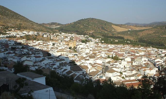
Photo: SergioBCN, Public domain.
Algodonales is a city and a Municipality, located in the province of Cádiz, Spain. According to the 2002 census, the city has a population of 5,607 inhabitants. Algodonales is situated 7 km north of Ermita de la Garganta Verde.
Grazalema

Photo: El Pantera, CC BY-SA 4.0.
Grazalema is a town of 2,050 people in the south-western Andalucia region of Spain. It is one of the largest 'white towns' of the Sierra la Grazalema national park, and is also Spain's wettest city.
Benamahoma
Hamlet

Photo: Wikimedia, CC BY-SA 4.0.
Benamahoma, one of the White Towns of Andalusia, is a town of some 400 inhabitants in Cádiz province, Spain. It is located 5 km from El Bosque, Cádiz, and lies within the Sierra de Grazalema Natural Park. Benamahoma is situated 8 km southwest of Ermita de la Garganta Verde.
Ermita de la Garganta Verde
- Type: Cave
- Category: landform
- Location: Zahara de la Sierra, Cádiz, Andalusia, Spain, Iberia, Europe
- View on OpenStreetMap
Latitude
36.81514° or 36° 48′ 55″ northLongitude
-5.40472° or 5° 24′ 17″ westOpen location code
8C8PRH8W+34OpenStreetMap ID
node 3662785265OpenStreetMap feature
natural=cave_entrance
This page is based on OpenStreetMap, Wikidata, and Wikimedia Commons.
We’d love your help improving our open data sources. Thank you for contributing.
Satellite Map
Discover Ermita de la Garganta Verde from above in high-definition satellite imagery.
Notable Places Nearby
Highlights include Cerro Cambronero and La Garganta Verde.
Nearby Places
Explore places such as Arroyo Molinos and Area Recreativa Arroyomolinos.
Cádiz: Must-Visit Destinations
Delve into Cádiz, Jerez de la Frontera, Algeciras, and Tarifa.
Curious Caves to Discover
Uncover intriguing caves from every corner of the globe.
About Mapcarta. Data © OpenStreetMap contributors and available under the Open Database License". Text is available under the CC BY-SA 4.0 license, except for photos, directions, and the map. Photo: Tango7174, CC BY-SA 4.0.