Pian Cusello
Pian Cusello is in Monteceneri, Lugano District, Ticino and has an elevation of 1,353 metres. Pian Cusello is situated nearby to the ruins Alpe Canigiolo, as well as near the peak Sasso Torrione.| Tap on a place to explore it |
Places of Interest Nearby
Highlights include Monte Tamaro and Monte Gradiccioli.
Monte Tamaro
Peak
 Monte Tamaro is a mountain of the Lugano Prealps, overlooking Lake Maggiore in the Swiss canton of Ticino. Reaching a height of 1,962 metres above sea level, it is the highest summit of the chain located between Lake Maggiore and Lake Lugano, which also includes Monte Lema.
Monte Gradiccioli
Peak
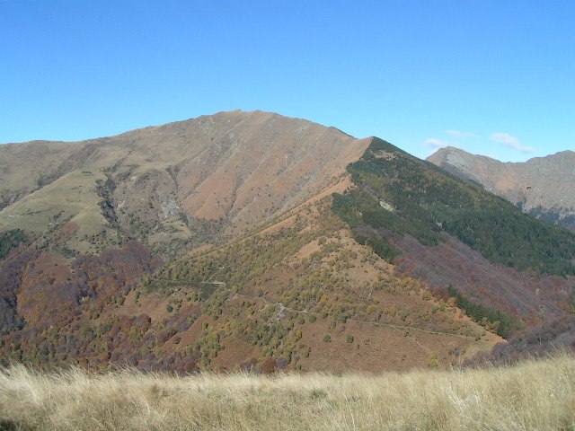
Photo: Elvezio, Public domain.
Monte Gradiccioli is a mountain of the Lugano Prealps, located between Indemini and Sigirino in the canton of Ticino. It lies south of Monte Tamaro, on the range between Lake Maggiore and Lake Lugano.
Capanna Tamaro
Mountain hut

Photo: Renek78, CC BY-SA 4.0.
Capanna Tamaro is a mountain hut, which is situated 2 km north of Pian Cusello.
Places in the Area
Nearby places include Mezzovico-Vira and Sigirino.
Mezzovico-Vira
Village
Mezzovico-Vira is a municipality in the district of Lugano in the canton of Ticino in Switzerland. Mezzovico-Vira is situated 3 km east of Pian Cusello.
Sigirino
Village
Sigirino is a former municipality in the district of Lugano in the canton of Ticino in Switzerland. The municipalities of Medeglia, Bironico, Camignolo, Rivera and Sigirino merged on 21 November 2010 into the new municipality of Monteceneri. Sigirino is situated 3½ km east of Pian Cusello.
Indemini
Village

Photo: Wikimedia, CC BY-SA 2.5.
Indemini is a former municipality in the district of Locarno in the canton of Ticino in Switzerland. On 25 April 2010, the former municipalities of Caviano, Contone, Gerra Gambarogno, Indemini, Magadino, Piazzogna, San Nazzaro, Sant'Abbondio and Vira Gambarogno merged into the new municipality of Gambarogno. Indemini is situated 4 km west of Pian Cusello.
Pian Cusello
- Type: Sign
- Categories: information and tourism
- Location: Monteceneri, Lugano District, Ticino, Switzerland, Central Europe, Europe
- View on OpenStreetMap
Latitude
46.09197° or 46° 5′ 31″ northLongitude
8.87731° or 8° 52′ 38″ eastElevation
1,353 metres (4,439 feet)Open location code
8FRC3VRG+QWOpenStreetMap ID
node 3684488257OpenStreetMap feature
tourism=information
This page is based on OpenStreetMap, Wikidata, and Wikimedia Commons.
We’d love your help improving our open data sources. Thank you for contributing.
Satellite Map
Discover Pian Cusello from above in high-definition satellite imagery.
Places with the Same Name
Discover other places named “Pian Cusello”.
Notable Places Nearby
Highlights include Alpe Canigiolo and Sasso Torrione.
Nearby Places
Explore places such as Pian Cusello and Alpe Canigiolo.
Ticino: Must-Visit Destinations
Delve into Lugano, Bellinzona, Locarno, and Ascona.
Curious Places to Discover
Uncover intriguing places from every corner of the globe.
About Mapcarta. Data © OpenStreetMap contributors and available under the Open Database License". Text is available under the CC BY-SA 4.0 license, except for photos, directions, and the map. Photo: Wikimedia, CC BY-SA 3.0.