swa Tankstelle
swa Tankstelle is a gas station in Augsburg, Bavarian Swabia, Bavaria. Access is restricted and requires permission. swa Tankstelle is situated nearby to the heritage site Haag-Villa, as well as near the art gallery Segenskunst.| Tap on a place to explore it |
Places of Interest Nearby
Highlights include Jakobertor and Fuggerei.
Jakobertor
City gate

Photo: S.wimmer, CC BY-SA 3.0.
Jakobertor is a city gate, which is situated 270 metres southwest of swa Tankstelle.
Fuggerei
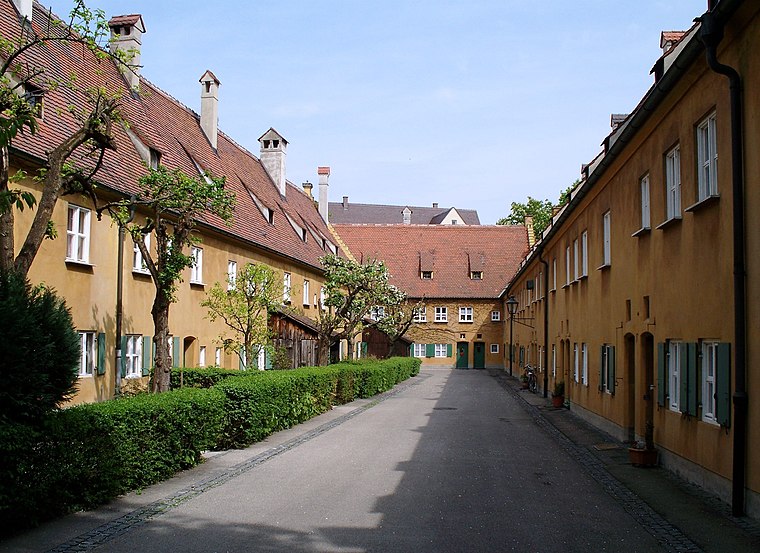
Photo: High Contrast, CC BY 3.0 de.
The Fuggerei is the world's oldest public housing complex still in use. It is a walled enclave within the city of Augsburg, Bavaria. It takes its name from the Fugger family and was founded in 1516 by Jakob Fugger the Younger as a place where the needy citizens of Augsburg could be housed. Fuggerei is situated 640 metres southwest of swa Tankstelle.
Augsburg Town Hall
Town hall

Photo: High Contrast, CC BY 3.0 de.
Augsburg Town Hall is the administrative centre of Augsburg, Bavaria, Germany, and one of the most significant secular buildings of the Renaissance style north of the Alps. Augsburg Town Hall is situated 1 km west of swa Tankstelle.
Places in the Area
Nearby places include Augsburg-Innenstadt and Proviantbachquartier.
Augsburg-Innenstadt
Suburb

Photo: Wikimedia, CC BY-SA 3.0.
Innenstadt is one of the seventeen highest level civic divisions, or Planungsräume, of the city of Augsburg, Bavaria, Germany. Located in the centre of the city, it is the most populated planning district, home to 49,222 residents as of December 31, 2022.
Proviantbachquartier
Neighborhood

Photo: Befana, Public domain.
Proviantbachquartier is a neighborhood.
Augsburg-Bismarckviertel
Neighborhood

Photo: Wikimedia, CC BY-SA 3.0.
Augsburg-Bismarckviertel is a neighborhood.
swa Tankstelle
- Access is restricted and requires permission.
- Type: Gas station
- Category: transportation
- Location: Augsburg, Bavarian Swabia, Bavaria, Germany, Central Europe, Europe
- View on OpenStreetMap
Latitude
48.37182° or 48° 22′ 19″ northLongitude
10.91185° or 10° 54′ 43″ eastOperator
Stadtwerke AugsburgOpen location code
8FWG9WC6+PPOpenStreetMap ID
node 3736653896OpenStreetMap feature
amenity=fuel
This page is based on OpenStreetMap, Wikidata, and Wikimedia Commons.
We’d love your help improving our open data sources. Thank you for contributing.
Satellite Map
Discover swa Tankstelle from above in high-definition satellite imagery.
Notable Places Nearby
Highlights include Haag-Villa and Segenskunst.
Nearby Places
Explore places such as Kantine Stadtwerke Augsburg and Besucherparkplatz Stadtwerke Augsburg.
Bavarian Swabia: Must-Visit Destinations
Delve into Memmingen, Kempten, Füssen, and Lindau.
Curious Gas Stations to Discover
Uncover intriguing gas stations from every corner of the globe.
About Mapcarta. Data © OpenStreetMap contributors and available under the Open Database License". Text is available under the CC BY-SA 4.0 license, except for photos, directions, and the map. Photo: Tilman2007, CC BY-SA 3.0.