La Bellangerais - Infos
La Bellangerais - Infos is in Rennes, Ille-et-Vilaine, Brittany. La Bellangerais - Infos is situated nearby to the sports venue Gymnase des Gantelles, as well as near the park Square Joséphine Pencalet.| Tap on a place to explore it |
Places of Interest Nearby
Highlights include Coulée verte de la pénétrante and Église Saint-Jean-Marie-Vianney de Rennes.
Coulée verte de la pénétrante
Park

Photo: Lektz, CC BY-SA 4.0.
Coulée verte de la pénétrante is a park, which is situated 380 metres northwest of La Bellangerais - Infos.
Église Saint-Jean-Marie-Vianney de Rennes
Church

Photo: Lektz, CC BY-SA 4.0.
Église Saint-Jean-Marie-Vianney de Rennes is a church, which is situated 330 metres east of La Bellangerais - Infos.
Les Gayeulles
Railway stop
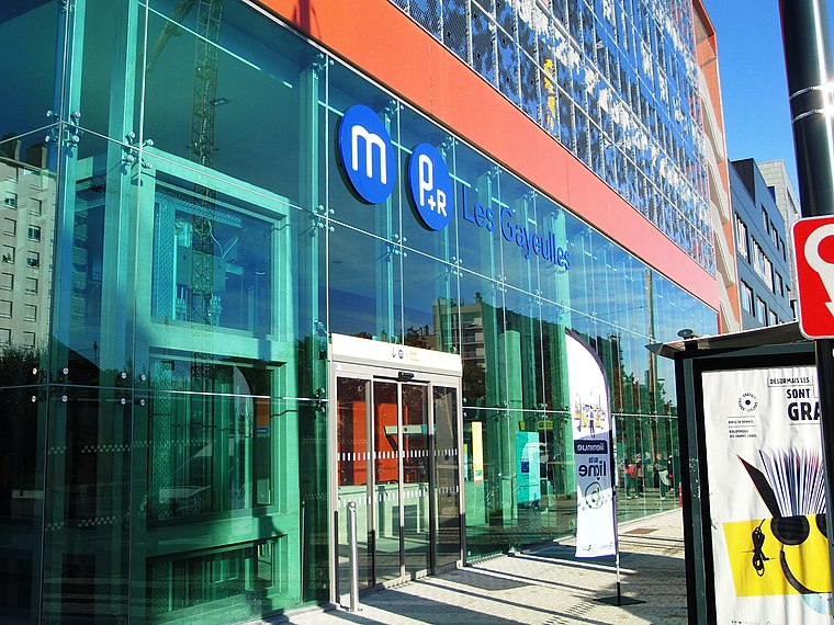
Photo: PanierAvide, CC BY-SA 4.0.
Les Gayeulles is a railway stop, which is situated 510 metres east of La Bellangerais - Infos.
Places in the Area
Nearby places include Cesson-Sévigné and Chantepie.
Cesson-Sévigné
Town

Photo: Pymouss44, CC BY-SA 3.0.
Cesson-Sévigné is a commune in the Ille-et-Vilaine department in Brittany in northwestern France. It is a suburb directly to the east of Rennes, bordered on its west side by the University of Rennes and the Technopole Atalante. Cesson-Sévigné is situated 4½ km east of La Bellangerais - Infos.
Chantepie
Town

Photo: DUMOUCH, CC BY-SA 3.0.
Chantepie is a commune of Rennes Métropole located in the Ille-et-Vilaine department in Brittany in northwestern France. Chantepie is situated 6 km southeast of La Bellangerais - Infos.
Betton
Town

Photo: SveA, CC BY-SA 3.0.
Betton is a commune in the Ille-et-Vilaine department in Brittany in northwestern France. It is nine kilometers north of the centre of Rennes. Betton is situated 6 km north of La Bellangerais - Infos.
La Bellangerais - Infos
- Type: Sign
- Categories: information and tourism
- Location: Rennes, Arrondissement of Rennes, Ille-et-Vilaine, Brittany, France, Europe
- View on OpenStreetMap
Latitude
48.13071° or 48° 7′ 51″ northLongitude
-1.66374° or 1° 39′ 50″ westOpen location code
8CWW48JP+7GOpenStreetMap ID
node 3751922929OpenStreetMap feature
tourism=information
This page is based on OpenStreetMap, Wikidata, and Wikimedia Commons.
We’d love your help improving our open data sources. Thank you for contributing.
Satellite Map
Discover La Bellangerais - Infos from above in high-definition satellite imagery.
Notable Places Nearby
Highlights include Gymnase des Gantelles and Square Joséphine Pencalet.
Nearby Places
Explore places such as Houx Cité U and Résidence Franz Heller.
Brittany: Must-Visit Destinations
Delve into Brest, Finistère, Morbihan, and Ille-et-Vilaine.
Curious Places to Discover
Uncover intriguing places from every corner of the globe.
About Mapcarta. Data © OpenStreetMap contributors and available under the Open Database License". Text is available under the CC BY-SA 4.0 license, except for photos, directions, and the map. Photo: Inkey, CC BY-SA 3.0.