Gendarmerie nationale
Gendarmerie nationale is a police station in Anse, Arrondissement of Villefranche-sur-Saône, Auvergne-Rhône-Alpes. Gendarmerie nationale is situated nearby to the pitch Salle Marie Marvingt, as well as near the sports venue Halle des sports.| Tap on a place to explore it |
- Opening hours:
Monday—Saturday: 8:30 AM—noon and 2:00 PM—6:30 PM
Sunday: 9:00 AM—noon and 3:00 PM—6:00 PM
public holidays: 9:00 AM—noon and 3:00 PM—6:00 PM - Type: Police station
- Also known as: “Gendarmerie - Brigade d’Anse”
Places of Interest Nearby
Highlights include Gare d’Anse and Église Saint-Pierre d’Anse.
Gare d’Anse
Railway station
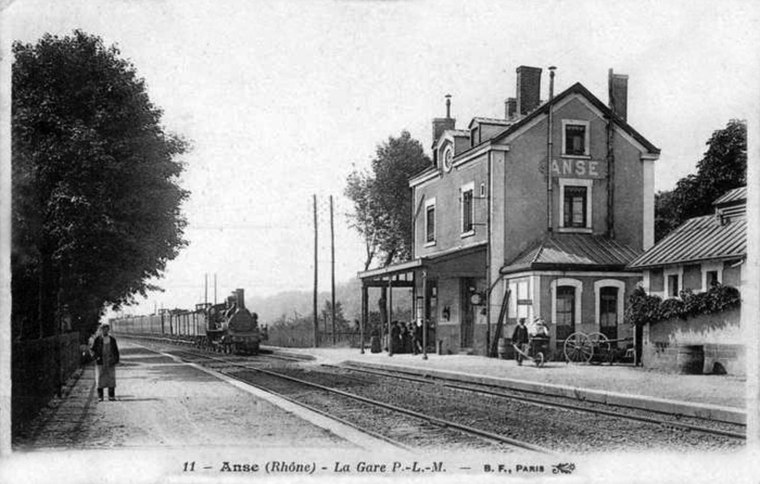
Photo: Wikimedia, Public domain.
Gare d’Anse is a railway station, which is situated 590 metres east of Gendarmerie nationale.
Église Saint-Pierre d’Anse
Church

Photo: Ansesolo, CC BY-SA 3.0.
Église Saint-Pierre d’Anse is a church, which is situated 570 metres southeast of Gendarmerie nationale.
Château des Tours

Photo: Groumfy69, CC BY-SA 3.0.
Château des Tours is situated 760 metres southeast of Gendarmerie nationale.
Places in the Area
Nearby places include Ambérieux and Pommiers.
Ambérieux
Village

Photo: Klodo6975, CC BY-SA 3.0.
Ambérieux, also known as Ambérieux-d'Azergues, is a commune in the Rhône department and the region of Auvergne-Rhône-Alpes, eastern France.
Pommiers
Village

Photo: Ansesolo, CC BY-SA 3.0.
Pommiers is a commune in the Rhône department in eastern France.
Lachassagne
Village

Photo: Michiel1972, CC BY-SA 3.0.
Lachassagne is a commune in the Rhône department in eastern France.
Gendarmerie nationale
Latitude
45.93925° or 45° 56′ 21″ northLongitude
4.71222° or 4° 42′ 44″ eastOperator
National GendarmerieOpen location code
8FQ6WPQ6+MVOpenStreetMap ID
node 3759187816OpenStreetMap feature
amenity=police
This page is based on OpenStreetMap, Wikidata, and Wikimedia Commons.
We’d love your help improving our open data sources. Thank you for contributing.
Satellite Map
Discover Gendarmerie nationale from above in high-definition satellite imagery.
Places with the Same Name
Discover other places named “Gendarmerie nationale”.
Notable Places Nearby
Highlights include Salle Marie Marvingt and Halle des sports.
Nearby Places
Explore places such as Collège Asa Paulini and Hôtel Saint-Romain.
Greater Lyon: Must-Visit Destinations
Delve into Lyon, Saint-Étienne, Roanne, and Villefranche-sur-Saône.
Curious Police Stations to Discover
Uncover intriguing police stations from every corner of the globe.
About Mapcarta. Data © OpenStreetMap contributors and available under the Open Database License". Text is available under the CC BY-SA 4.0 license, except for photos, directions, and the map. Photo: Goudan07, CC BY-SA 3.0.