Sportparkur
Sportparkur is a playground in Düren, Cologne District, North Rhine-Westphalia. Sportparkur is situated nearby to Nordpark, as well as near the public building Haus für Alle - Düren.| Tap on a place to explore it |
Places of Interest Nearby
Highlights include Fatih-Moschee and Saint Joachim Church.
Fatih-Moschee
Mosque

Photo: Zauberfee88, CC BY-SA 3.0 de.
Fatih-Moschee is a mosque, which is situated 390 metres south of Sportparkur.
Saint Joachim Church
Church

Photo: Wikimedia, CC BY-SA 3.0.
Saint Joachim Church is situated 450 metres east of Sportparkur.
Düren station
Railway station
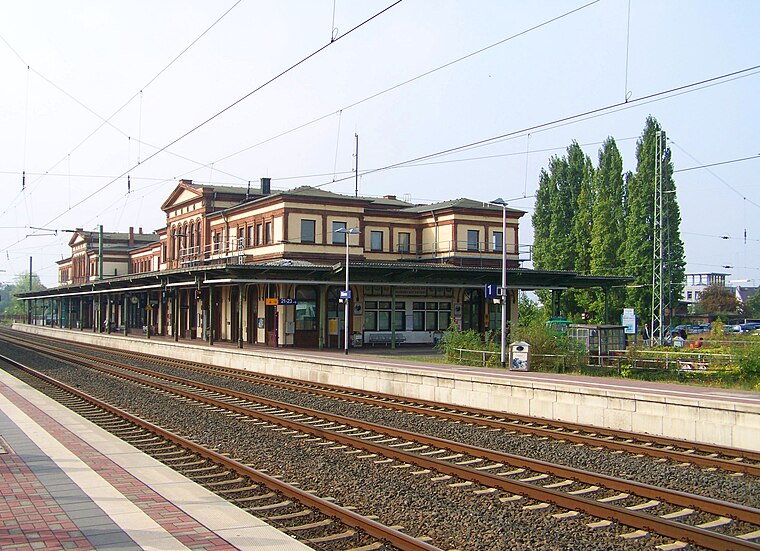
Photo: Zauberfee88, Public domain.
Düren station is located to the north of the centre of Düren and is the largest station in the city and the district of Düren. It is located at the intersection of the Cologne–Aachen high-speed line with the lines to Linnich, Heimbach and Euskirchen. Düren station is situated 1 km east of Sportparkur.
Places in the Area
Nearby places include Düren and Grüngürtel.
Düren
Town

Photo: Wikimedia, CC BY-SA 4.0.
Düren is a town in North Rhine-Westphalia, Germany, between Aachen and Cologne, on the river Rur.

Gürzenich
Village

Photo: NDG, CC BY-SA 4.0.
Gürzenich is a village, which is situated 2½ km southwest of Sportparkur.
Sportparkur
- Type: Playground
- Category: recreation area
- Location: Düren, Cologne District, North Rhine-Westphalia, Germany, Central Europe, Europe
- View on OpenStreetMap
Latitude
50.81265° or 50° 48′ 46″ northLongitude
6.47208° or 6° 28′ 20″ eastOpen location code
9F28RF7C+3ROpenStreetMap ID
node 3785145610OpenStreetMap feature
leisure=playground
This page is based on OpenStreetMap, Wikidata, and Wikimedia Commons.
We’d love your help improving our open data sources. Thank you for contributing.
Satellite Map
Discover Sportparkur from above in high-definition satellite imagery.
Notable Places Nearby
Highlights include Nordpark and Spielplatz Nordpark.
Nearby Places
Explore places such as Realschule Bretzelnweg and Realschule Bretzelnweg.
North Rhine-Westphalia: Must-Visit Destinations
Delve into Cologne, Düsseldorf, Bonn, and Dortmund.
Curious Playgrounds to Discover
Uncover intriguing playgrounds from every corner of the globe.
About Mapcarta. Data © OpenStreetMap contributors and available under the Open Database License". Text is available under the CC BY-SA 4.0 license, except for photos, directions, and the map. Photo: Daniel Schwen, CC BY-SA 2.5.