Mode Schöchlin
Mode Schöchlin is a clothing store in Thalwil, Horgen District, Canton of Zurich. Mode Schöchlin is situated nearby to the government office DLZ Soziales, as well as near the police station Polizeiposten Gemeindepolizei Thalwil.| Tap on a place to explore it |
Places of Interest Nearby
Highlights include Museum Thalwil and Jenny Estate.

Jenny Estate
Building

Photo: Roland zh, CC BY-SA 3.0.
Jenny Estate is a large estate in the municipality of Thalwil of the Canton of Zurich in Switzerland. It is a Swiss heritage site of national significance.
Thalwil railway station
Railway station

Photo: Bobo11, CC BY-SA 3.0.
Thalwil railway station is a railway station in the municipality of Thalwil in the Swiss canton of Zurich. The station is located within fare zone 150 of the Zürcher Verkehrsverbund. Thalwil railway station is situated 490 metres north of Mode Schöchlin.
Places in the Area
Nearby places include Thalwil and Oberrieden.
Thalwil
Town

Photo: Iotatau, CC BY-SA 3.0.
Thalwil is a municipality and town in the district of Horgen in the canton of Zürich in Switzerland. The municipality includes two parts: Thalwil and Gattikon.
Oberrieden
Village
Oberrieden is a municipality in the district of Horgen in the canton of Zurich in Switzerland. It is one of the towns along the south shore of Lake Zurich.
Rüschlikon
Village
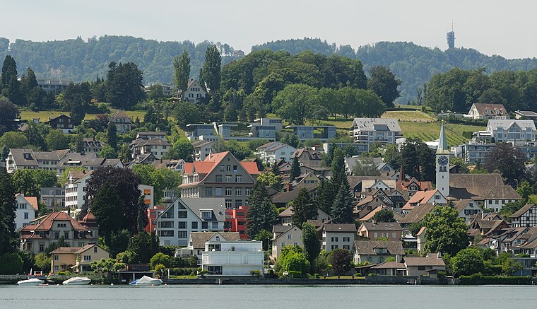
Photo: Iotatau, CC BY-SA 3.0.
Rüschlikon is a municipality in the district of Horgen in the canton of Zürich in Switzerland. It is located on the west shore of Lake Zürich.
Mode Schöchlin
- Opening hours:
Monday: 1:30 PM—6:30 PM
Tuesday—Friday: 9:00 AM—12:30 PM and 1:30 PM—6:30 PM
Saturday: 9:00 AM—5:00 PM
public holidays: closed - Type: Clothing store
- Category: shop
- Location: Thalwil, Horgen District, Canton of Zurich, Switzerland, Central Europe, Europe
- View on OpenStreetMap
Latitude
47.2916° or 47° 17′ 30″ northLongitude
8.56546° or 8° 33′ 56″ eastOpen location code
8FVC7HR8+J5OpenStreetMap ID
node 3815185775OpenStreetMap feature
shop=clothes
This page is based on OpenStreetMap, Wikidata, and Wikimedia Commons.
We’d love your help improving our open data sources. Thank you for contributing.
Satellite Map
Discover Mode Schöchlin from above in high-definition satellite imagery.
Notable Places Nearby
Highlights include DLZ Soziales and Polizeiposten Gemeindepolizei Thalwil.
Nearby Places
Explore places such as Pfisterscheune and Thalwil, Mühlebachplatz.
Switzerland: Must-Visit Destinations
Delve into Zurich, Berne, Geneva, and Basel.
Curious Clothing Stores to Discover
Uncover intriguing clothing stores from every corner of the globe.
About Mapcarta. Data © OpenStreetMap contributors and available under the Open Database License". Text is available under the CC BY-SA 4.0 license, except for photos, directions, and the map. Photo: Wikimedia, CC0.