Rural Agricultural Development Authority (RADA)
Rural Agricultural Development Authority (RADA) is a government office in Morant Bay, Saint Thomas Parish. Rural Agricultural Development Authority (RADA) is situated nearby to the ruins Morant Bay Court House, as well as near Fort Morant (1758).| Tap on a place to explore it |
Places in the Area
Nearby places include Morant Bay and Lyssons.
Morant Bay
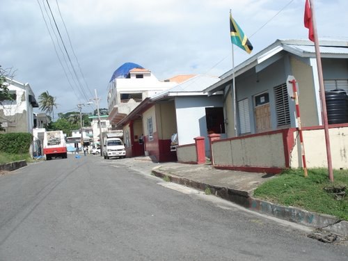
Photo: IchHier--15er, CC BY-SA 3.0 de.
Morant Bay is a town in southeastern Jamaica and the capital of the parish of St. Thomas, located about 40 kilometres east of Kingston, the capital. The parish has a population of 94,410.
Lyssons
Village
Lyssons is a largely residential community located in the parish of St. Thomas, Jamaica. It lies east of the capital, Morant Bay, and neighbors the communities of Retreat, Prospect and Leith Hall. Lyssons is situated 2½ km east of Rural Agricultural Development Authority (RADA).
Airy Castle
Hamlet
Airy Castle is a village in the Jamaican parish of Saint Thomas. Airy Castle is situated 7 km northeast of Rural Agricultural Development Authority (RADA).
Rural Agricultural Development Authority (RADA)
- Opening hours: 9:00 AM—5:00 PM
- Type: Government office
- Categories: office and government building
- Location: Morant Bay, Saint Thomas Parish, Jamaica, Caribbean, North America
- View on OpenStreetMap
Latitude
17.88236° or 17° 52′ 57″ northLongitude
-76.40142° or 76° 24′ 5″ westOpen location code
7795VHJX+WCOpenStreetMap ID
node 3823078858OpenStreetMap feature
office=government
This page is based on OpenStreetMap, Wikidata, and Wikimedia Commons.
We’d love your help improving our open data sources. Thank you for contributing.
Satellite Map
Discover Rural Agricultural Development Authority (RADA) from above in high-definition satellite imagery.
Notable Places Nearby
Highlights include Morant Bay Court House and Fort Morant (1758).
Nearby Places
Explore places such as Morant Villas and Superior farms & Garden Center.
Jamaica: Must-Visit Destinations
Delve into Kingston, Montego Bay, Portmore, and Blue Mountains.
Curious Government Offices to Discover
Uncover intriguing government offices from every corner of the globe.
About Mapcarta. Data © OpenStreetMap contributors and available under the Open Database License". Text is available under the CC BY-SA 4.0 license, except for photos, directions, and the map. Photo: papushin, CC BY-SA 2.0.