Adidas
Adidas is a sport shop in Maricopa County, Arizona which is located on North 95th Avenue. Adidas is situated nearby to the miniature golf course PopStroke, as well as near Glendale Convention Center.| Tap on a place to explore it |
- Type: Sport shop
- Address: 950, 6800 North 95th Avenue, Glendale, AZ 85305
- Wheelchair access: yes
Places of Interest Nearby
Highlights include Desert Diamond Arena and Westgate Entertainment District.
Desert Diamond Arena
Stadium
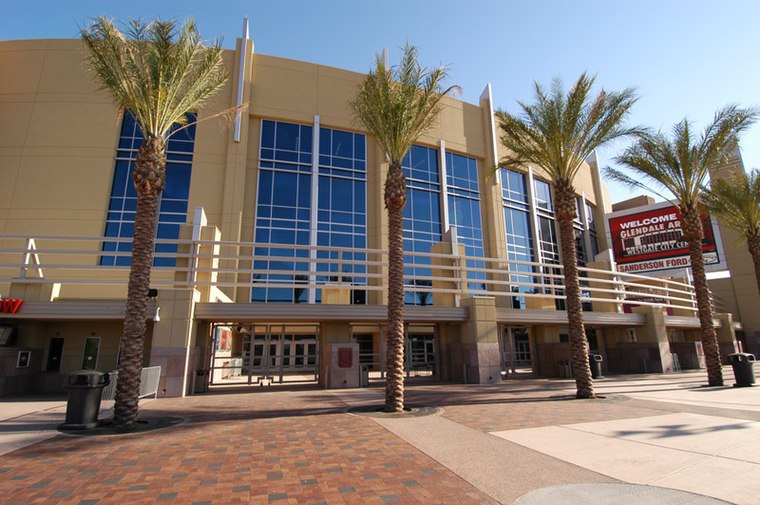 Desert Diamond Arena is an indoor entertainment arena located in Glendale, Arizona, which anchors the 223-acre, $1 billion Westgate Entertainment District. Desert Diamond Arena is situated 1,700 feet east of Adidas.
Westgate Entertainment District
Commercial area
Westgate Entertainment District, formerly known as "Westgate City Center" is a mixed-use development in Glendale, Arizona. Westgate is described as a super-regional destination for shopping, dining, entertainment, and commercial offices. Westgate Entertainment District is situated 1,500 feet east of Adidas.
Raymond S. Kellis High School
School
Raymond S. Kellis High School is a public secondary school located in Glendale, Arizona, United States, part of the Peoria Unified School District. It opened in August 2004 due to overcrowding at Peoria High School and rapid population growth in the surrounding area. Raymond S. Kellis High School is situated 1¼ miles northeast of Adidas.
Places in the Area
Nearby places include Peoria and Maryvale.
Peoria

Photo: Ceemo, CC BY-SA 3.0.
Peoria is a city inside of Phoenix, Arizona. Many visitors come to the area during the spring to see their favorite professional baseball team during Spring Training in the Cactus League.
Maryvale
Suburb

Photo: Doc Searls, CC BY 2.0.
Maryvale is an urban village of Phoenix, Arizona. Maryvale is situated 4 miles southeast of Adidas.
Glendale

Photo: Jninja, CC BY-SA 3.0.
Glendale is one of the largest suburbs in the metropolitan Phoenix area, and is rapidly growing as a media/entertainment center in the Valley of the Sun. It was home to over 250,000 people in 2019.
Adidas
- Category: shop
- Location: Maricopa County, Arizona, Southwest, United States, North America
- View on OpenStreetMap
Latitude
33.53352° or 33° 32′ 1″ northLongitude
-112.2665° or 112° 15′ 59″ westBrand
Adidas AGOpen location code
8559GPMM+CCOpenStreetMap ID
node 3823718576OpenStreetMap feature
shop=sportsOpenStreetMap attribute
wheelchair=yes
This page is based on OpenStreetMap, Wikidata, and Wikimedia Commons.
We’d love your help improving our open data sources. Thank you for contributing.
Satellite Map
Discover Adidas from above in high-definition satellite imagery.
Places with the Same Name
Discover other places named “Adidas”.
Notable Places Nearby
Highlights include PopStroke and Glendale Convention Center.
Nearby Places
Explore places such as Vuori and OluKai.
Arizona: Must-Visit Destinations
Delve into Phoenix, Tucson, Mesa, and Flagstaff.
Curious Sport Shops to Discover
Uncover intriguing sport shops from every corner of the globe.
About Mapcarta. Data © OpenStreetMap contributors and available under the Open Database License". Text is available under the CC BY-SA 4.0 license, except for photos, directions, and the map. Photo: Tobi 87, CC BY-SA 3.0.