Kita Chinderpalast
Kita Chinderpalast is a kindergarten in Gebenstorf, Baden District, Canton of Aargau. Kita Chinderpalast is situated nearby to the shopping center Geelig Zentrum, as well as near the mosque Moschee Gebenstorf.| Tap on a place to explore it |
Places of Interest Nearby
Highlights include Turgi railway station and Reformed parish church and rectory.
Turgi railway station
Railway station
 Turgi railway station is a railway station in the municipality of Turgi in the Swiss canton of Aargau. The station is located on the Zurich to Olten main line, and is the junction for the Turgi–Koblenz–Waldshut line. Turgi railway station is situated 610 metres east of Kita Chinderpalast.
Reformed parish church and rectory
Church

Photo: Badener, CC BY-SA 3.0.
Reformed parish church and rectory is situated 730 metres east of Kita Chinderpalast.
Reformed Church
Church

Photo: Schlarpi, CC BY-SA 4.0.
Reformed Church is situated 1 km south of Kita Chinderpalast.
Places in the Area
Nearby places include Turgi and Untersiggenthal.
Turgi
Village

Photo: Roland zh, CC BY-SA 3.0.
Turgi is a former municipality in the district of Baden in the canton of Aargau in Switzerland, located in the Limmat Valley. It merged with Baden on 1 January 2024. In 2002, Turgi received the Wakker Prize for the preservation of its architectural heritage.
Untersiggenthal
Village
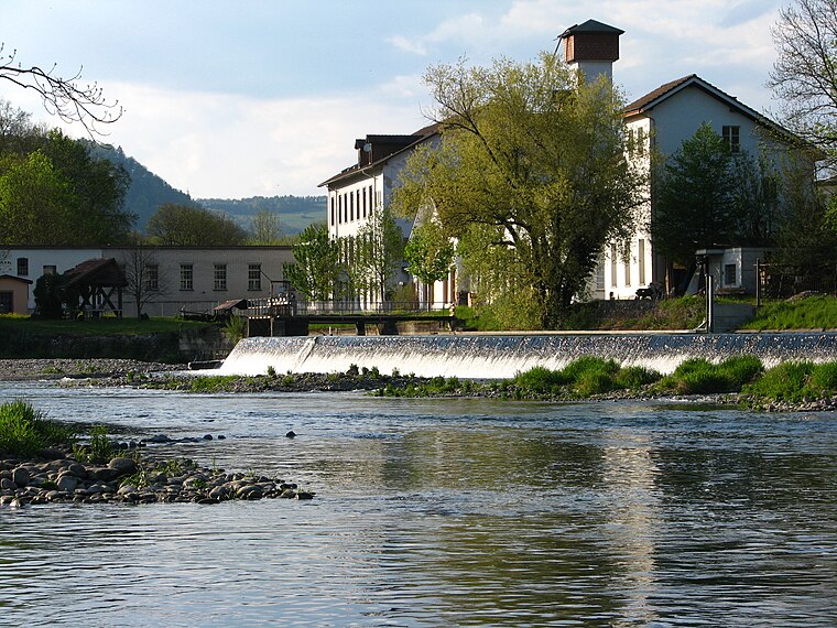
Photo: Roland zh, CC BY-SA 3.0.
Untersiggenthal is a municipality in the district of Baden in the canton of Aargau in Switzerland, located in the Limmat Valley.

Kita Chinderpalast
- Email: info@chinderpalast.ch
- Type: Kindergarten
- Category: education
- Location: Gebenstorf, Baden District, Canton of Aargau, Switzerland, Central Europe, Europe
- View on OpenStreetMap
Latitude
47.4907° or 47° 29′ 27″ northLongitude
8.24503° or 8° 14′ 42″ eastOpen location code
8FVCF6RW+72OpenStreetMap ID
node 3824185339OpenStreetMap feature
amenity=kindergarten
This page is based on OpenStreetMap, Wikidata, and Wikimedia Commons.
We’d love your help improving our open data sources. Thank you for contributing.
Satellite Map
Discover Kita Chinderpalast from above in high-definition satellite imagery.
Notable Places Nearby
Highlights include Geelig Zentrum and Moschee Gebenstorf.
Nearby Places
Explore places such as Besucher Parkplatz and Apotheke am Wasserschloss.
Switzerland: Must-Visit Destinations
Delve into Zurich, Berne, Geneva, and Basel.
Curious Kindergartens to Discover
Uncover intriguing kindergartens from every corner of the globe.
About Mapcarta. Data © OpenStreetMap contributors and available under the Open Database License". Text is available under the CC BY-SA 4.0 license, except for photos, directions, and the map. Photo: Simonizer, CC BY-SA 2.0 de.