Zwickauer Damm
Zwickauer Damm is a railway stop in Berlin, Berlin. Zwickauer Damm is situated nearby to the church Apostolische Kirche Berlin, as well as near the school Schule am Fliederbusch.| Tap on a place to explore it |
Places of Interest Nearby
Highlights include Zwickauer Damm and Wutzkyallee.
Zwickauer Damm
Metro station
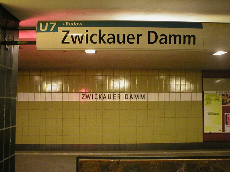
Photo: Jcornelius, CC BY-SA 3.0.
Zwickauer Damm is a Berlin U-Bahn station located on the U7. Finished in 1970 by R. G. Rümmler it was the end of the line U7 until 1972 when Rudow station was opened. The next station is Rudow.
Wutzkyallee
Metro station

Photo: ReferenceBK, CC BY-SA 3.0.
Wutzkyallee is a Berlin U-Bahn station located on the U7. Designed by R.G.Rümmler and opened in 1970 it should be named "Efeuweg"; however, it was opened with the current name. The next station is Zwickauer Damm. Wutzkyallee is situated 640 metres west of Zwickauer Damm.
St. Joseph (Berlin-Rudow)
Church

Photo: Bodo Kubrak, CC0.
St. Joseph (Berlin-Rudow) is a church, which is situated 1 km southeast of Zwickauer Damm.
Places in the Area
Nearby places include Johannisthal and Kosmosviertel.
Johannisthal
Suburb

Photo: Clemensfranz, CC BY-SA 3.0.
Johannisthal is a German locality within the Berlin borough of Treptow-Köpenick. Until 2001 it was part of the former borough of Treptow. Johannisthal is situated 3 km northeast of Zwickauer Damm.
Kosmosviertel
Quarter

Photo: Fridolin freudenfett, CC BY-SA 3.0.
Kosmosviertel is a quarter, which is situated 3½ km southeast of Zwickauer Damm.
Hufeisensiedlung
Quarter

Photo: Benbuschfeld, CC BY 3.0.
The Hufeisensiedlung is a housing estate in Berlin, built in 1925–33. It was designed by architect Bruno Taut, municipal planning head and co-architect Martin Wagner, garden architect Leberecht Migge and Neukölln gardens director Ottokar Wagler. Hufeisensiedlung is situated 3½ km northwest of Zwickauer Damm.
Zwickauer Damm
- Type: Railway stop
- Categories: transport stop and transportation
- Location: Berlin, Berlin, Stadt, Berlin, Germany, Central Europe, Europe
- View on OpenStreetMap
Latitude
52.42327° or 52° 25′ 24″ northLongitude
13.48407° or 13° 29′ 3″ eastOpen location code
9F4MCFFM+8JOpenStreetMap ID
node 3856551776OpenStreetMap feature
public_transport=stop_positionOpenStreetMap feature
railway=stop
This page is based on OpenStreetMap, Wikidata, and Wikimedia Commons.
We’d love your help improving our open data sources. Thank you for contributing.
Satellite Map
Discover Zwickauer Damm from above in high-definition satellite imagery.
Places with the Same Name
Discover other places named “Zwickauer Damm”.
Notable Places Nearby
Highlights include U-Bhf Zwickauer Damm and Apostolische Kirche Berlin.
Nearby Places
Explore places such as U Zwickauer Damm and BVC Computer.
Berlin: Must-Visit Destinations
Delve into Mitte, East Central, City West, and East Berlin.
Curious Railway Stops to Discover
Uncover intriguing railway stops from every corner of the globe.
About Mapcarta. Data © OpenStreetMap contributors and available under the Open Database License". Text is available under the CC BY-SA 4.0 license, except for photos, directions, and the map. Photo: Berthold Werner, CC BY-SA 3.0.