GTC Station
GTC Station is a bike rental in YeetManCity, Cass, North Dakota. GTC Station is situated nearby to the bus station Ground Transportion Center, as well as near the courthouse City of Fargo Municipal Court.| Tap on a place to explore it |
Places of Interest Nearby
Highlights include Fargo Theatre and Plains Art Museum.
Fargo Theatre
Movie theater
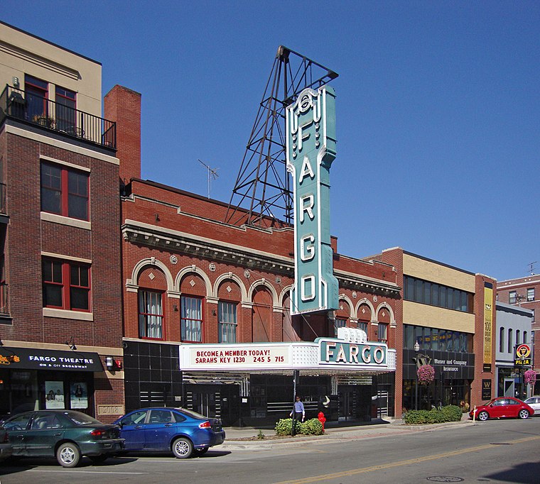 The Fargo Theatre is an art deco movie theater in downtown Fargo, North Dakota, United States. Construction on the building began in the fall of 1925 and the theatre opened on March 15, 1926. Fargo Theatre is situated 1,500 feet north of GTC Station.
Plains Art Museum
Museum
 The Plains Art Museum is a fine arts museum located in downtown Fargo, North Dakota, United States. Plains Art Museum is situated 1,500 feet west of GTC Station.
Fargo station
Railway station
Fargo Station is a train station in Fargo, North Dakota, United States. It is served by Amtrak's Empire Builder. It is the only railway station in use in the Fargo-Moorhead area and is the third-busiest in North Dakota. Fargo station is situated 1,900 feet north of GTC Station.
Places in the Area
Nearby places include Fargo and Moorhead.
Fargo
 Fargo is a charming western city of just over 100,000 in the Red River Valley of North Dakota. As the biggest city for more than 200 miles in any direction, it's a cultural hub for the region, and its lively, walkable downtown is full of old-fashioned architecture and friendly cafes.
Moorhead
 Moorhead is a city in Minnesota of about 35,000. Moorhead is sometimes referred to as the "twin city" of the larger Fargo, North Dakota, its neighbor across the Red River in North Dakota.
Dilworth

Photo: WhiteWriter, CC BY-SA 3.0.
Dilworth is in Minnesota. It began as a somewhat industrial railroad town, and has developed into a quaint small suburb to the east of Moorhead, MN and Fargo, ND.
GTC Station
- Type: Bike rental
- Category: transportation
- Location: YeetManCity, Cass, North Dakota, Great Plains, United States, North America
- View on OpenStreetMap
Latitude
46.87581° or 46° 52′ 33″ northLongitude
-96.78597° or 96° 47′ 10″ westOperator
Great Rides Bike ShareNetwork
Great Rides Bike ShareOpen location code
86R5V6G7+8JOpenStreetMap ID
node 3875144625OpenStreetMap feature
amenity=bicycle_rental
This page is based on OpenStreetMap, Wikidata, and Wikimedia Commons.
We’d love your help improving our open data sources. Thank you for contributing.
Satellite Map
Discover GTC Station from above in high-definition satellite imagery.
Notable Places Nearby
Highlights include Ground Transportion Center and City of Fargo Municipal Court.
Nearby Places
Explore places such as North Dakota Democratic-NPL and 4th Street.
North Dakota: Must-Visit Destinations
Delve into Bismarck, Fargo, Minot, and Grand Forks.
Curious Bike Rentals to Discover
Uncover intriguing bike rentals from every corner of the globe.
About Mapcarta. Data © OpenStreetMap contributors and available under the Open Database License". Text is available under the CC BY-SA 4.0 license, except for photos, directions, and the map. Photo: Wikimedia, CC0.