Viralata
Viralata is an office in Bonfim, Porto. Viralata is situated nearby to the church Templo Adventista do Sétimo Dia, as well as near the playground Parque Infantil de Soares dos Reis.| Tap on a place to explore it |
Places of Interest Nearby
Highlights include Museu Militar do Porto and Junta de Freguesia do Bonfim.
Museu Militar do Porto
Museum

Photo: JotaCartas, CC BY-SA 3.0.
The Museu Militar do Porto is a pertaining institution to the Portuguese Army, dedicated for the preservation of military history, located in Porto, Portugal. Museu Militar do Porto is situated 190 metres southeast of Viralata.
Junta de Freguesia do Bonfim
Town hall
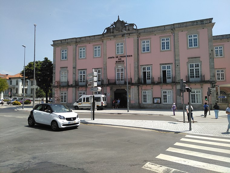
Photo: Threeohsix, CC BY-SA 4.0.
Junta de Freguesia do Bonfim is a town hall, which is situated 200 metres northwest of Viralata.
Campo 24 de Agosto station
Railway station

Photo: Ymblanter, CC BY-SA 4.0.
Campo 24 de Agosto is a light rail station on the Porto Metro system in Porto, Portugal. The station is underground, adjacent to the Campo 24 de Agosto square, from which it takes its name. Campo 24 de Agosto station is situated 290 metres northwest of Viralata.
Places in the Area
Nearby places include Fontainhas and Santo Ildefonso.

Santo Ildefonso
Neighborhood

Photo: Wikimedia, CC BY-SA 3.0.
Santo Ildefonso is a former civil parish in the municipality of Porto, Portugal. In 2013, the parish merged into the new parish Cedofeita, Santo Ildefonso, Sé, Miragaia, São Nicolau e Vitória. The population in 2011 was 9,029, in an area of 1.24 km2.
Encosta dos Guindais
Neighborhood

Photo: Wikimedia, CC BY-SA 3.0.
Encosta dos Guindais is a neighborhood.
Viralata
- Type: Voluntary association
- Category: office
- Location: Bonfim, Porto, Porto District, Portugal, Iberia, Europe
- View on OpenStreetMap
Latitude
41.14656° or 41° 8′ 48″ northLongitude
-8.59679° or 8° 35′ 48″ westOpen location code
8CHH4CW3+J7OpenStreetMap ID
node 3896080904OpenStreetMap feature
office=association
This page is based on OpenStreetMap, Wikidata, and Wikimedia Commons.
We’d love your help improving our open data sources. Thank you for contributing.
Satellite Map
Discover Viralata from above in high-definition satellite imagery.
Notable Places Nearby
Highlights include Templo Adventista do Sétimo Dia and Parque Infantil de Soares dos Reis.
Nearby Places
Explore places such as Panela do Vizinho and SUMO.
Portugal: Must-Visit Destinations
Delve into Lisbon, Caldas da Rainha, Coimbra, and Braga.
Curious Places to Discover
Uncover intriguing places from every corner of the globe.
About Mapcarta. Data © OpenStreetMap contributors and available under the Open Database License". Text is available under the CC BY-SA 4.0 license, except for photos, directions, and the map. Photo: Olegivvit, CC BY 2.5.