Kopitar-Kreuz
Kopitar-Kreuz is a wayside shrine in Keutschach am See, Klagenfurt-Land District, Carinthia. Kopitar-Kreuz is situated nearby to the church Filialkirche St. Nikolai, as well as near the playground Zauberwald.| Tap on a place to explore it |
Places of Interest Nearby
Highlights include Baßgeigensee and Rauschelesee.
Baßgeigensee

Photo: Johann Jaritz, CC BY-SA 3.0.
Baßgeigensee is a lake of Carinthia, Austria. Baßgeigensee is situated 1 km southwest of Kopitar-Kreuz.
Rauschelesee
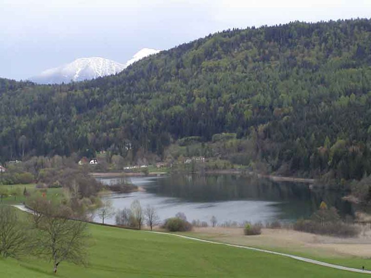
Photo: Rauschelesee, CC BY 2.5.
Rauschelesee is a lake in Keutschacher Seental near Lake Keutschach in the town Keutschach, Carinthia, Austria. The lake is used for fishing and swimming.
Villa Engelhart, Reifnitz
House

Photo: Johann Jaritz, CC BY-SA 4.0.
Villa Engelhart, Reifnitz is a house, which is situated 2 km north of Kopitar-Kreuz.
Places in the Area
Nearby places include Krumpendorf am Wörthersee and Maria Rain.
Krumpendorf am Wörthersee
Village

Photo: Wikimedia, Public domain.
Krumpendorf am Wörthersee is a municipality in Klagenfurt-Land District, in Carinthia, Austria. It is situated on the Wörthersee. Krumpendorf am Wörthersee is situated 4 km north of Kopitar-Kreuz.
Maria Rain
Village

Photo: Joadl, CC BY-SA 3.0.
Maria Rain is a town in the district of Klagenfurt-Land in the Austrian state of Carinthia, known for its Baroque parish and pilgrimage church. Maria Rain is situated 7 km southeast of Kopitar-Kreuz.
Pörtschach

Photo: Johann Jaritz, CC BY-SA 3.0 at.
Pörtschach am Wörthersee is a municipality in the district of Klagenfurt-Land in Carinthia, Austria. It is an established summer resort and lakeside town on Wörthersee.
Kopitar-Kreuz
- Type: Wayside shrine
- Denomination: Catholic
- Category: historic site
- Location: Keutschach am See, Klagenfurt-Land District, Carinthia, Austria, Central Europe, Europe
- View on OpenStreetMap
Latitude
46.59129° or 46° 35′ 29″ northLongitude
14.21196° or 14° 12′ 43″ eastOpen location code
8FRPH6R6+GQOpenStreetMap ID
node 392314203OpenStreetMap feature
historic=wayside_shrineOpenStreetMap attribute
denomination=catholic
This page is based on OpenStreetMap, Wikidata, and Wikimedia Commons.
We’d love your help improving our open data sources. Thank you for contributing.
Satellite Map
Discover Kopitar-Kreuz from above in high-definition satellite imagery.
Notable Places Nearby
Highlights include Filialkirche St. Nikolai and Zauberwald.
Nearby Places
Explore places such as Keuschnigkreuz and Reichenhauser.
Carinthia: Must-Visit Destinations
Delve into Klagenfurt, Villach, Wörthersee, and Spittal an der Drau.
Curious Wayside Shrines to Discover
Uncover intriguing wayside shrines from every corner of the globe.
About Mapcarta. Data © OpenStreetMap contributors and available under the Open Database License". Text is available under the CC BY-SA 4.0 license, except for photos, directions, and the map. Photo: Wikimedia, CC BY-SA 3.0.