dbox CrossFit
dbox CrossFit is a health club in Bonn, Cologne District, North Rhine-Westphalia which is located on Siemensstraße. dbox CrossFit is situated nearby to the sports venue Boulders Habitat, as well as near the health club jumpers fitness.| Tap on a place to explore it |
Places of Interest Nearby
Highlights include Propsthof Nord and August-Macke-Haus.
Propsthof Nord
Tram stop
 Propsthof Nord is a tram stop, which is situated 210 metres northeast of dbox CrossFit.
August-Macke-Haus
Museum
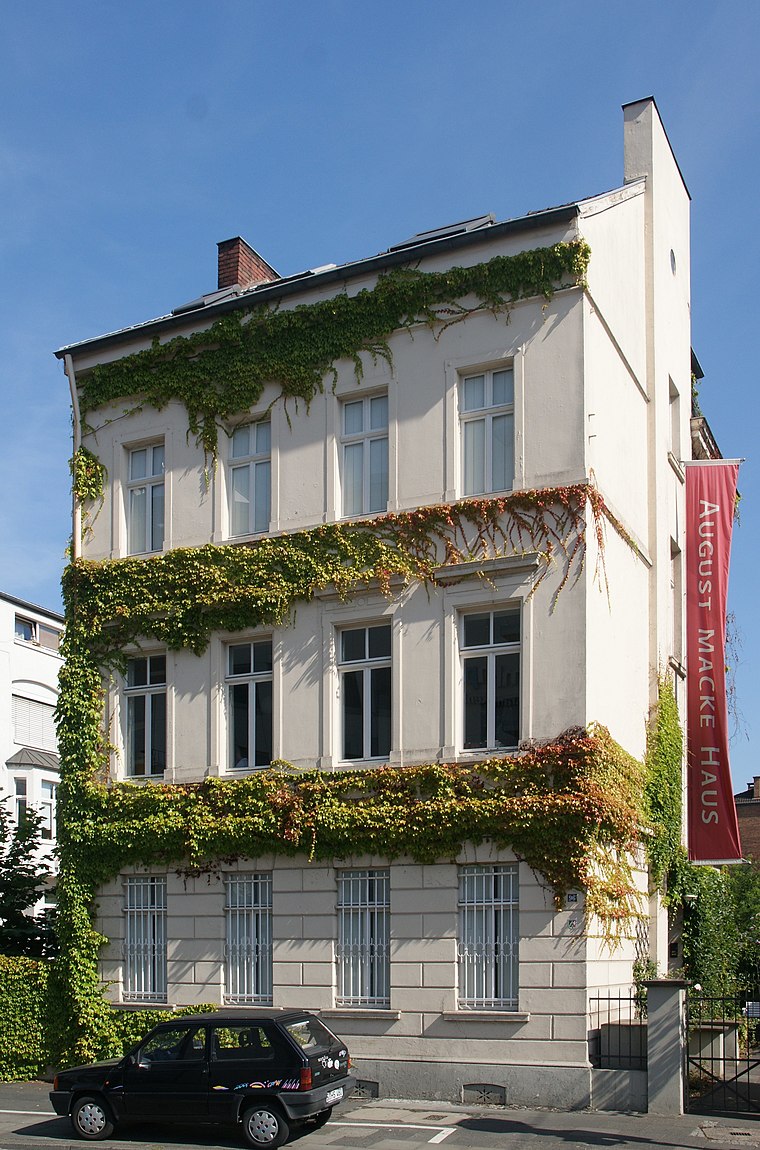
Photo: Tohma, CC BY-SA 4.0.
The August-Macke-Haus or August Macke House is a museum in Bonn, Germany, opened in 1991, dedicated to the expressionist painter August Macke. It is located in Macke's former home, where he lived from 1911 to 1914. August-Macke-Haus is situated 1 km east of dbox CrossFit.
Apostelkirche
Church

Photo: Hasenläufer, CC BY-SA 3.0 de.
Apostelkirche is a church, which is situated 680 metres northwest of dbox CrossFit.
Places in the Area
Nearby places include Endenich and Tannenbusch.
Endenich
Quarter

Photo: Mrhubble, CC BY-SA 3.0.
Endenich is a neighborhood in the western part of Bonn, Germany. Before 1904 it was an independent municipality. The village of Endenich was founded in the 8th century, and was first mentioned in 804 as Antiniche. Today, about 12,000 people live in Endenich.
Tannenbusch
Quarter

Photo: JWohlfahrt, CC BY-SA 3.0.
Tannenbusch is a section of Bonn, Germany with approx. 17,000 inhabitants. It is split between the subsections Alt-Tannenbusch and Neu-Tannenbusch. The roads in Tannenbusch are almost exclusively named after places in the former GDR and former eastern territories of Germany.
Poppelsdorf
Quarter
Bonn is a federal city in the German state of North Rhine-Westphalia, located on the banks of the Rhine. With a population exceeding 300,000, it lies about 24 km south-southeast of Cologne, in the southernmost part of the Rhine-Ruhr region.
dbox CrossFit
- Type: Health club
- Address: Siemensstraße 24, Bonn, 53121
- Categories: gym, recreation area, and sports location
- Location: Bonn, Cologne District, Cologne Lowland, North Rhine-Westphalia, Germany, Central Europe, Europe
- View on OpenStreetMap
Latitude
50.73793° or 50° 44′ 17″ northLongitude
7.0713° or 7° 4′ 17″ eastOpen location code
9F29P3QC+5GOpenStreetMap ID
node 3933388145OpenStreetMap feature
leisure=fitness_centreOpenStreetMap feature
sport=crossfit
This page is based on OpenStreetMap, Wikidata, and Wikimedia Commons.
We’d love your help improving our open data sources. Thank you for contributing.
Satellite Map
Discover dbox CrossFit from above in high-definition satellite imagery.
Notable Places Nearby
Highlights include Boulders Habitat and jumpers fitness.
Nearby Places
Explore places such as dbox Physio and WSR Services.
Cologne Lowland: Must-Visit Destinations
Delve into Cologne, Leverkusen, Siegburg, and Bad Honnef.
Curious Health Clubs to Discover
Uncover intriguing health clubs from every corner of the globe.
About Mapcarta. Data © OpenStreetMap contributors and available under the Open Database License". Text is available under the CC BY-SA 4.0 license, except for photos, directions, and the map. Photo: Danapit, CC BY-SA 3.0.