Barranc de Vallverdú
Barranc de Vallverdú is a valley in Vilaplana, Tarragona, Catalonia. Barranc de Vallverdú is situated nearby to the locality Bosc del Mas de Vallverdú, as well as near los Pregons.| Tap on a place to explore it |
Places of Interest
Highlights include La Mussara and Puig d’en Gulló.
La Mussara
Peak

Photo: Wikimedia, CC BY-SA 3.0.
La Mussara is a mountain of Catalonia, Spain. It is the highest peak of the Serra de la Mussara, a subrange of the Prades Mountains. Located north of the town of Vilaplana, La Mussara has an elevation of 1055 metres above sea level.


Places in the Area
Nearby places include l’Albiol Municipality and l’Aleixar Municipality.
l’Albiol Municipality
Village

Photo: Wikimedia, Public domain.
L'Albiol is a municipality in the comarca of Baix Camp, in the province of Tarragona, Catalonia, Spain. It has a population of 537. The Prades Mountains are located within the municipal term of the town. The 1791 church is dedicated to Saint Michael.
l’Aleixar Municipality
Village

Photo: Tabalot, Public domain.
L'Aleixar is a municipality in the comarca of Baix Camp, in the province of Tarragona, Catalonia, Spain. It has a population of 962. The Serra de la Mussara, a subrange of the Prades Mountains rises north of the town. The church is dedicated to Saint Martin.
Almoster Municipality
Village
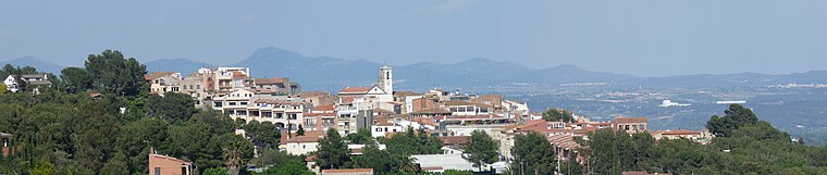
Photo: Tabalot, Public domain.
Almoster is a village in the province of Tarragona and autonomous community of Catalonia, Spain. It has a population of 1,338.
Barranc de Vallverdú
- Type: Valley
- Category: landform
- Location: Vilaplana, Tarragona, Catalonia, Eastern Spain, Spain, Iberia, Europe
- View on OpenStreetMap
Latitude
41.2363° or 41° 14′ 11″ northLongitude
1.0697° or 1° 4′ 11″ eastOpen location code
8FH363P9+GVOpenStreetMap ID
node 4014268231OpenStreetMap feature
natural=valley
This page is based on OpenStreetMap, Wikidata, and Wikimedia Commons.
We’d love your help improving our open data sources. Thank you for contributing.
Satellite Map
Discover Barranc de Vallverdú from above in high-definition satellite imagery.
In Other Languages
“Barranc de Vallverdú” goes by many names.
- Catalan: “Barranc de Vallverdú”
Localities in the Area
Explore places such as Bosc del Mas de Vallverdú and los Pregons.
Notable Places Nearby
Highlights include lo Maset Petit and Bosc Petit de Flassada.
Tarragona: Must-Visit Destinations
Delve into Tarragona, Reus, Tortosa, and Salou.
Curious Valleys to Discover
Uncover intriguing valleys from every corner of the globe.
About Mapcarta. Data © OpenStreetMap contributors and available under the Open Database License". Text is available under the CC BY-SA 4.0 license, except for photos, directions, and the map. Photo: Lluket, CC BY-SA 3.0.