Karla Dornbach
Karla Dornbach is a bus stop in Straden, Südoststeiermark District, Styria. Karla Dornbach is situated nearby to the forest Grabenhölzer, as well as near Kapaunwald.| Tap on a place to explore it |
Places of Interest Nearby
Highlights include Kapelle Radochen and Ortskapelle Oberpurkla.
Kapelle Radochen
Chapel

Photo: Zeitblick, CC BY-SA 3.0.
Kapelle Radochen is a chapel, which is situated 1¼ km south of Karla Dornbach.
Ortskapelle Oberpurkla
Church
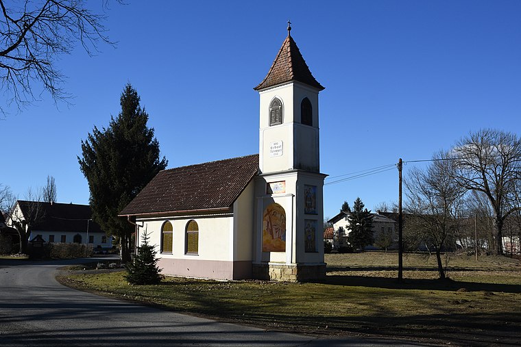
Photo: Iswoar, CC BY-SA 4.0.
Ortskapelle Oberpurkla is a church, which is situated 3 km south of Karla Dornbach.
Fire station in Oberpurkla
Fire station
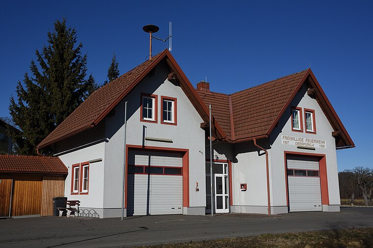
Photo: Iswoar, CC BY-SA 4.0.
Fire station in Oberpurkla is situated 3 km south of Karla Dornbach.
Places in the Area
Nearby places include Hof bei Straden and Stainz bei Straden.
Hof bei Straden
Hamlet

Photo: Ueb-at, CC BY-SA 3.0.
Hof bei Straden is a former municipality in the district of Südoststeiermark in Austrian state of Styria. Since the 2015 Styria municipal structural reform, it is part of the municipality Straden. Hof bei Straden is situated 3 km north of Karla Dornbach.
Stainz bei Straden
Hamlet

Photo: Gliwi, CC BY-SA 4.0.
Stainz bei Straden is a former municipality in the district of Südoststeiermark in the Austrian state of Styria. Since the 2015 Styria municipal structural reform, it is part of the municipality Straden. Stainz bei Straden is situated 5 km north of Karla Dornbach.
Ratschendorf
Village

Photo: Christian Pirkl, CC BY-SA 4.0.
Ratschendorf is a former municipality in the district of Südoststeiermark in the Austrian state of Styria. Since the 2015 Styria municipal structural reform, it is part of the municipality Deutsch Goritz. Ratschendorf is situated 7 km southwest of Karla Dornbach.
Karla Dornbach
- Type: Bus stop
- Categories: transport stop and transportation
- Location: Straden, Südoststeiermark District, Styria, Austria, Central Europe, Europe
- View on OpenStreetMap
Latitude
46.77339° or 46° 46′ 24″ northLongitude
15.89689° or 15° 53′ 49″ eastOpen location code
8FRQQVFW+9QOpenStreetMap ID
node 4034693164OpenStreetMap feature
public_transport=stop_position
This page is based on OpenStreetMap, Wikidata, and Wikimedia Commons.
We’d love your help improving our open data sources. Thank you for contributing.
Satellite Map
Discover Karla Dornbach from above in high-definition satellite imagery.
Notable Places Nearby
Highlights include Grabenhölzer and Bürgerservicestelle Straden.
Nearby Places
Explore places such as Karla Dornbach and Karla Dornbach.
Styria: Must-Visit Destinations
Delve into Graz, Leoben, Bruck an der Mur, and Kapfenberg.
Curious Bus Stops to Discover
Uncover intriguing bus stops from every corner of the globe.
About Mapcarta. Data © OpenStreetMap contributors and available under the Open Database License". Text is available under the CC BY-SA 4.0 license, except for photos, directions, and the map. Photo: Kmarka, CC BY-SA 3.0.