PR-TF 65.1
PR-TF 65.1 is in Buenavista del Norte, Santa Cruz de Tenerife. PR-TF 65.1 is situated nearby to the peak Risco Blanco, as well as near Roque Blanco.| Tap on a place to explore it |
Places of Interest Nearby
Highlights include Iglesia de San Fernando Rey and Conjunto Histórico El Caserío de Masca.
Iglesia de San Fernando Rey
Church

Photo: Florival fr, CC BY-SA 3.0.
Iglesia de San Fernando Rey is a church, which is situated 1½ km northeast of PR-TF 65.1.
Conjunto Histórico El Caserío de Masca
Protected area

Photo: Wikimedia, CC BY-SA 3.0.
Conjunto Histórico El Caserío de Masca is a protected area, which is situated 2½ km northwest of PR-TF 65.1.
Places in the Area
Nearby places include El Retamar and Santiago del Teide.

Santiago del Teide

Photo: Wikimedia, CC BY-SA 4.0.
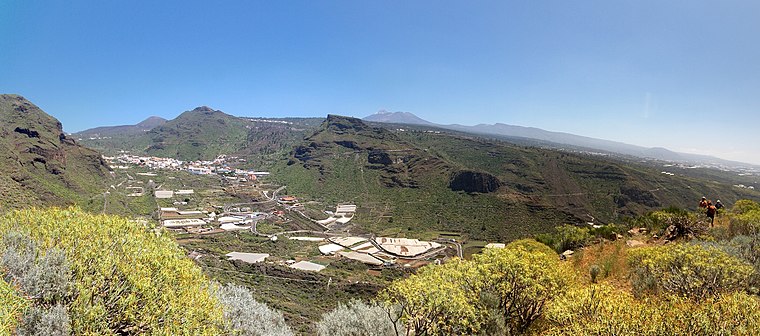
Santiago del Teide is a town and a municipality in the western part of the island Tenerife, Canary Islands, and part of the province of Santa Cruz de Tenerife.
PR-TF 65.1
- Type: Sign
- Categories: information and tourism
- Location: Buenavista del Norte, Santa Cruz de Tenerife, Canary Islands, Spain, Iberia, Europe
- View on OpenStreetMap
Latitude
28.28729° or 28° 17′ 14″ northLongitude
-16.82697° or 16° 49′ 37″ westOpen location code
7CW575PF+W6OpenStreetMap ID
node 4041836133OpenStreetMap feature
tourism=information
This page is based on OpenStreetMap, Wikidata, and Wikimedia Commons.
We’d love your help improving our open data sources. Thank you for contributing.
Satellite Map
Discover PR-TF 65.1 from above in high-definition satellite imagery.
Notable Places Nearby
Highlights include Risco Blanco and Roque Blanco.
Nearby Places
Explore places such as Los Quemados and Don’t continue here! Path blocked by finca just before the road!.
Canary Islands: Must-Visit Destinations
Delve into Santa Cruz de Tenerife, Las Palmas, La Palma, and La Gomera.
Curious Places to Discover
Uncover intriguing places from every corner of the globe.
About Mapcarta. Data © OpenStreetMap contributors and available under the Open Database License". Text is available under the CC BY-SA 4.0 license, except for photos, directions, and the map. Photo: Wikimedia, CC BY-SA 4.0.