Gemeindeamt Oberloisdorf
Gemeindeamt Oberloisdorf is a community center in Oberloisdorf, Oberpullendorf District, Burgenland which is located on Hauptstraße. Gemeindeamt Oberloisdorf is situated nearby to the church Pfarrkirche hl. Rochus, as well as near the public building Leichenhalle.| Tap on a place to explore it |
Places of Interest Nearby
Highlights include Pfarrkirche hl. Rochus and Kriegerdenkmal Oberloisdorf.
Pfarrkirche hl. Rochus
Church

Photo: Steindy, CC BY-SA 2.0 de.
Pfarrkirche hl. Rochus is a church, which is situated 130 metres northeast of Gemeindeamt Oberloisdorf.
Kriegerdenkmal Oberloisdorf
Memorial

Photo: Iswoar, CC BY-SA 3.0.
Kriegerdenkmal Oberloisdorf is a memorial, which is situated 150 metres northeast of Gemeindeamt Oberloisdorf.
Rustenkreuz
Wayside cross

Photo: Robert Heilinger, CC BY-SA 3.0.
Rustenkreuz is a wayside cross, which is situated 740 metres southeast of Gemeindeamt Oberloisdorf.
Places in the Area
Nearby places include Liebing and Hammerteich.
Liebing
Village
Photo: Wikimedia, Public domain.
Liebing is a village in the district of Oberpullendorf in Burgenland in Austria. It is part of the municipality of Mannersdorf an der Rabnitz. Liebing is situated 3½ km south of Gemeindeamt Oberloisdorf.
Hammerteich
Village
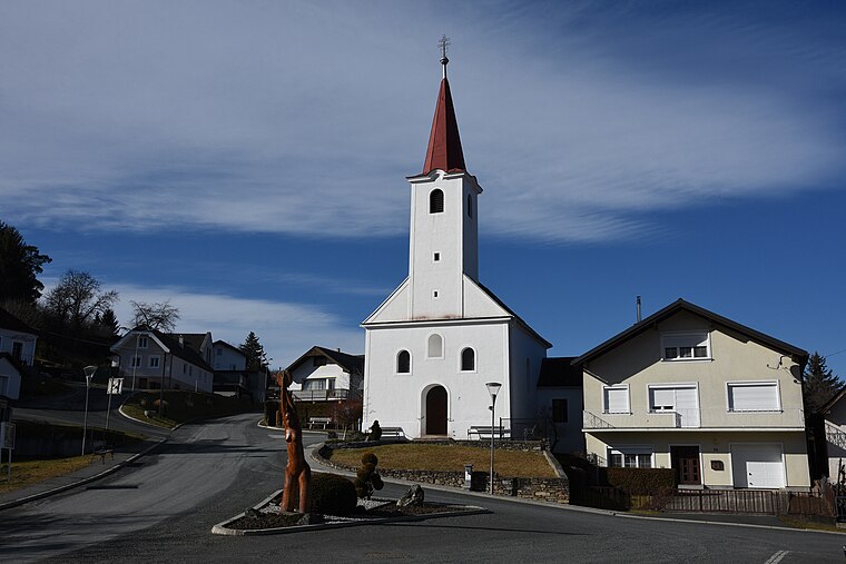
Photo: Iswoar, CC BY-SA 4.0.
Hammerteich is a village, which is situated 6 km southwest of Gemeindeamt Oberloisdorf.
Kőszeg

Photo: Zairon, CC BY-SA 3.0.
Kőszeg is a historical town in Vas county, in Hungary. Another beautiful town beside Sopron, it is often referred to as the "jewellery box of the country". Like Sopron, it is very close to the Austrian border.
Gemeindeamt Oberloisdorf
- Type: Community center
- Address: Hauptstraße 63, Oberloisdorf, 7451
- Location: Oberloisdorf, Oberpullendorf District, Burgenland, Austria, Central Europe, Europe
- View on OpenStreetMap
Latitude
47.44586° or 47° 26′ 45″ northLongitude
16.50429° or 16° 30′ 16″ eastOpen location code
8FVRCGW3+8POpenStreetMap ID
node 4045672180OpenStreetMap feature
amenity=community_centre
This page is based on OpenStreetMap, Wikidata, and Wikimedia Commons.
We’d love your help improving our open data sources. Thank you for contributing.
Satellite Map
Discover Gemeindeamt Oberloisdorf from above in high-definition satellite imagery.
Notable Places Nearby
Highlights include Leichenhalle and Dorfgemeinschaftshaus-Dorfmuseum.
Nearby Places
Explore places such as Pfarrheim and Pestkreuz.
Burgenland: Must-Visit Destinations
Delve into Eisenstadt, Neusiedl am See, Rust, and Güssing.
Curious Community Centers to Discover
Uncover intriguing community centers from every corner of the globe.
About Mapcarta. Data © OpenStreetMap contributors and available under the Open Database License". Text is available under the CC BY-SA 4.0 license, except for photos, directions, and the map. Photo: Wikimedia, CC BY-SA 4.0.