Schlachtfeld 1806
Schlachtfeld 1806 is in Jena, Thuringia. Schlachtfeld 1806 is situated nearby to the peak Dornberg, as well as near the church Dorfkirche Closewitz.| Tap on a place to explore it |
Places of Interest Nearby
Highlights include Dorfkirche Closewitz and St. Nikolaus (Lützeroda).
Dorfkirche Closewitz
Church

Photo: Wikswat, CC BY-SA 3.0.
Dorfkirche Closewitz is a church, which is situated 720 metres southeast of Schlachtfeld 1806.
St. Nikolaus (Lützeroda)
Church

Photo: Wikswat, CC BY-SA 3.0.
St. Nikolaus (Lützeroda) is a church, which is situated 1 km southwest of Schlachtfeld 1806.
Dorfkirche Krippendorf
Church

Photo: Wikswat, CC BY-SA 3.0.
Dorfkirche Krippendorf is a church, which is situated 1½ km northwest of Schlachtfeld 1806.
Places in the Area
Nearby places include Lehesten and Rödigen.
Lehesten
Village
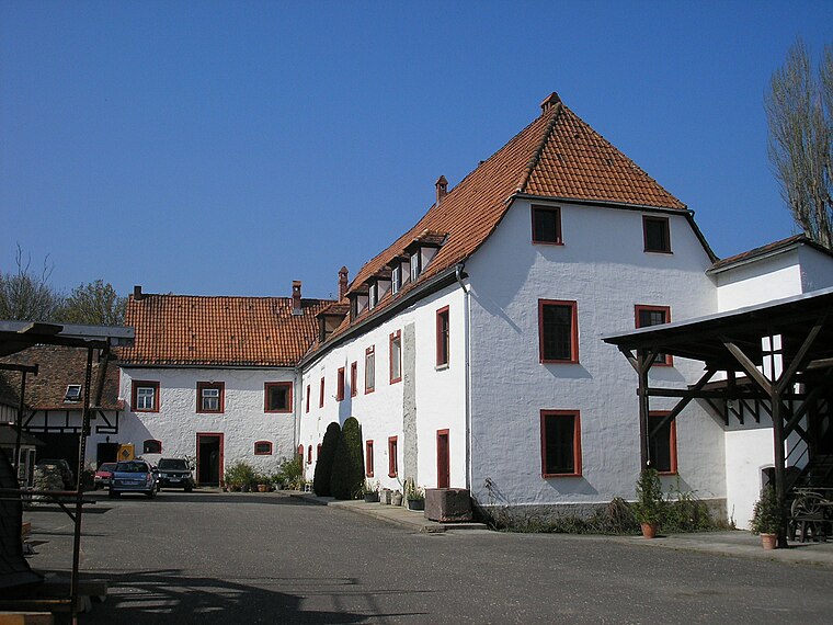
Photo: Michael Sander, CC BY-SA 3.0.
Lehesten is a municipality in the district Saale-Holzland, in Thuringia, Germany.
Rödigen
Village

Photo: Lars0001, Public domain.
Rödigen is a village, which is situated 3 km northeast of Schlachtfeld 1806.
Damenviertel
Neighborhood

Photo: J. Triepke, CC BY 2.0.
Damenviertel is a neighborhood, which is situated 4 km southeast of Schlachtfeld 1806.
Schlachtfeld 1806
- Type: Sign
- Categories: information and tourism
- Location: Jena, Thuringia, Germany, Central Europe, Europe
- View on OpenStreetMap
Latitude
50.96426° or 50° 57′ 51″ northLongitude
11.56372° or 11° 33′ 49″ eastOpen location code
9F2HXH77+PFOpenStreetMap ID
node 407844244OpenStreetMap feature
tourism=information
This page is based on OpenStreetMap, Wikidata, and Wikimedia Commons.
We’d love your help improving our open data sources. Thank you for contributing.
Satellite Map
Discover Schlachtfeld 1806 from above in high-definition satellite imagery.
Notable Places Nearby
Highlights include Dornberg and Freiwillige Feuerwehr Jena OT Closewitz.
Nearby Places
Explore places such as 1806 and Serbe-Tümpel.
Thuringia: Must-Visit Destinations
Delve into Erfurt, Weimar, Gera, and Eisenach.
Curious Places to Discover
Uncover intriguing places from every corner of the globe.
About Mapcarta. Data © OpenStreetMap contributors and available under the Open Database License". Text is available under the CC BY-SA 4.0 license, except for photos, directions, and the map. Photo: Taxiarchos228, FAL.