Wiener Blut
Wiener Blut is a bar in Mariahilf, Vienna which is located on Faulmanngasse. Wiener Blut is situated nearby to the post office Post Filiale 1043, as well as near the government office GIS.| Tap on a place to explore it |
Places of Interest Nearby
Highlights include Secession Building and Vienna State Opera.
Secession Building
Museum

Photo: Bwag, CC BY-SA 4.0.
The Secession Building is a contemporary art exhibition hall in Vienna, Austria. It was completed in 1898 by Joseph Maria Olbrich as an architectural manifesto for the Vienna Secession, a group of rebel artists that seceded from the long-established fine art institution. Secession Building is situated 190 metres north of Wiener Blut.
Vienna State Opera
Theater building

Photo: P e z i, CC BY-SA 3.0 at.
The Vienna State Opera is a historic opera house and opera company based in Vienna, Austria. The 1,709-seat Renaissance Revival venue was the first major building on the Vienna Ring Road. Vienna State Opera is situated 580 metres northeast of Wiener Blut.
Karlskirche
Church
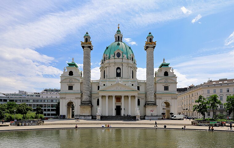
Photo: Bwag, CC BY-SA 4.0.
The Karlskirche is a Baroque church in the Karlsplatz in Vienna, Austria. The church is dedicated to Saint Charles Borromeo, a leading figure of the Counter-Reformation. The church is located on the border of Wieden and the Innere Stadt, the city centre. Karlskirche is situated 500 metres east of Wiener Blut.
Places in the Area
Nearby places include Wieden and Saint Ulrich.
Wieden

Photo: Xenophon, CC BY-SA 3.0.
Wieden is the fourth district of Vienna. Its north border is the Vienna river, the Prinz Eugen Straße the east and the Gürtel the south.

Neubau

Photo: Ralf Roletschek, CC BY-SA 3.0.
Neubau is the 7th district of Vienna. Its border to the south is the popular Mariahilfer Strasse, to the west the Gürtel, and to the north Lerchenfelder Straße. The Neubau district contains many artsy places like the Museumsquartier.
Wiener Blut
- Type: Bar
- Address: Faulmanngasse 5, Wien, 1040
- Location: Mariahilf, Vienna, Austria, Central Europe, Europe
- View on OpenStreetMap
Latitude
48.19886° or 48° 11′ 56″ northLongitude
16.36517° or 16° 21′ 55″ eastOpen location code
8FWR59X8+G3OpenStreetMap ID
node 4096953621OpenStreetMap feature
amenity=bar
This page is based on OpenStreetMap, Wikidata, and Wikimedia Commons.
We’d love your help improving our open data sources. Thank you for contributing.
Satellite Map
Discover Wiener Blut from above in high-definition satellite imagery.
Places with the Same Name
Discover other places named “Wiener Blut”.
Notable Places Nearby
Highlights include Post Filiale 1043 and GIS.
Nearby Places
Explore places such as Cha No Ma and Nippon-Ya 日本屋.
Vienna: Must-Visit Destinations
Delve into Innere Stadt, Vienna International Airport, Inner East, and Hietzing.
Curious Bars to Discover
Uncover intriguing bars from every corner of the globe.
About Mapcarta. Data © OpenStreetMap contributors and available under the Open Database License". Text is available under the CC BY-SA 4.0 license, except for photos, directions, and the map. Photo: Wikimedia, CC BY-SA 3.0.