Wasserbehälter Lengefeld
Wasserbehälter Lengefeld is in Pockau-Lengefeld, Erzgebirgskreis, Saxony. Wasserbehälter Lengefeld is situated nearby to the peak Wettinfels, as well as near the village Rauenstein.| Tap on a place to explore it |
Places of Interest Nearby
Highlights include Lengefeld Lime Works and Kgl.-sächs. Postmeilenstein Lengefeld.
Lengefeld Lime Works
Museum

Photo: Miebner, CC BY-SA 3.0.
The Lengefeld Lime Works was a limestone mine southwest of Lengefeld in the Saxon town of Pockau-Lengefeld in the Ore Mountains. In 2016, the mine was closed. Lengefeld Lime Works is situated 1¼ km south of Wasserbehälter Lengefeld.
Kgl.-sächs. Postmeilenstein Lengefeld
Historic site

Photo: Altsprachenfreund, CC BY-SA 4.0.
Kgl.-sächs. Postmeilenstein Lengefeld is a historic site, which is situated 1¼ km northeast of Wasserbehälter Lengefeld.
Kgl.-sächs. Postmeilenstein Kalkwerk
Historic site

Photo: Wikimedia, CC BY-SA 3.0.
Kgl.-sächs. Postmeilenstein Kalkwerk is a historic site, which is situated 1¼ km south of Wasserbehälter Lengefeld.
Places in the Area
Nearby places include Lengefeld and Rauenstein.
Lengefeld
Town
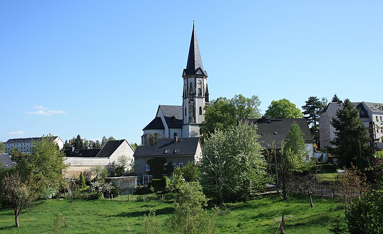
Photo: Devilsanddust, CC BY-SA 3.0.
Lengefeld is a town and a former municipality in the district Erzgebirgskreis, in the Free State of Saxony, Germany. It is situated in the Ore Mountains, 23 km southeast of Chemnitz.
Rauenstein
Village
 Rauenstein is a village, which is situated 2½ km northeast of Wasserbehälter Lengefeld.
Pockau
Village

Photo: Devilsanddust, CC BY-SA 3.0.
Pockau is a village and a former municipality in the district of Erzgebirgskreis in Saxony, Germany. On 1 January 2014 it was merged with the town Lengefeld to form the town Pockau-Lengefeld. Pockau is on the Silver Road. Pockau is situated 3½ km east of Wasserbehälter Lengefeld.
Wasserbehälter Lengefeld
- Type: Sign
- Categories: information and tourism
- Location: Pockau-Lengefeld, Erzgebirgskreis, Saxony, Germany, Central Europe, Europe
- View on OpenStreetMap
Latitude
50.71228° or 50° 42′ 44″ northLongitude
13.17789° or 13° 10′ 40″ eastOpen location code
9F2MP56H+W5OpenStreetMap ID
node 4097846859OpenStreetMap feature
tourism=information
This page is based on OpenStreetMap, Wikidata, and Wikimedia Commons.
We’d love your help improving our open data sources. Thank you for contributing.
Satellite Map
Discover Wasserbehälter Lengefeld from above in high-definition satellite imagery.
Notable Places Nearby
Highlights include Weißer Ofen and Rathaus.
Nearby Places
Explore places such as Obervorwerk and Oberer Teil, Lengefeld (Erzgeb).
Saxony: Must-Visit Destinations
Delve into Dresden, Leipzig, Chemnitz, and Meißen.
Curious Places to Discover
Uncover intriguing places from every corner of the globe.
About Mapcarta. Data © OpenStreetMap contributors and available under the Open Database License". Text is available under the CC BY-SA 4.0 license, except for photos, directions, and the map. Photo: Taxiarchos228, FAL.