Erable de Montpellier
Erable de Montpellier is a park in Villeneuve-lès-Avignon, Arrondissement of Nîmes, Occitanie. Erable de Montpellier is situated nearby to the church Chapelle Notre-Dame de Consolation, as well as near the park La Colline des Mourgues.| Tap on a place to explore it |
Places of Interest Nearby
Highlights include Tour Philippe-le-Bel and Pont Saint-Bénézet.
Tour Philippe-le-Bel

Photo: Véronique PAGNIER, Public domain.
Tour Philippe-le-Bel is a medieval tower in Villeneuve-lès-Avignon which marked the French terminus of the Saint-Bénézet Bridge across the Rhone between the Kingdom of France and Papal territory of Avignon. Tour Philippe-le-Bel is situated 190 metres south of Erable de Montpellier.
Pont Saint-Bénézet

Photo: Chimigi, CC BY-SA 2.0 fr.
The Pont Saint-Bénézet, also known as the Pont d'Avignon, was a medieval bridge across the Rhône in the town of Avignon, in southern France. Only four arches survive. Pont Saint-Bénézet is situated 1 km southeast of Erable de Montpellier.
Collegiate Church of Notre-Dame, Villeneuve-lès-Avignon
Church

Photo: Vpe, Public domain.
The Collegiate Church of Notre-Dame is a Gothic church in Villeneuve-lès-Avignon, Gard, Occitanie, France. Collegiate Church of Notre-Dame, Villeneuve-lès-Avignon is situated 340 metres north of Erable de Montpellier.
Places in the Area
Nearby places include Villeneuve-lès-Avignon and Ile Piot.
Villeneuve-lès-Avignon
Town
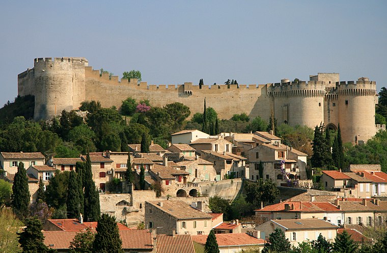
Photo: Luu, CC BY-SA 3.0.
Villeneuve-lès-Avignon is a commune in the Gard department in southern France. It can also be spelled Villeneuve-lez-Avignon.

Avignon

Photo: Brateevsky, CC BY-SA 3.0.
Avignon is the capital of the French department of Vaucluse in Provence-Alpes-Côte d'Azur, and is on the banks of the Rhône river. Avignon was one of the European Cities of Culture in 2000 and its historical centre has been inscribed on the UNESCO World Heritage list.
Erable de Montpellier
- Type: Park
- Category: recreation area
- Location: Villeneuve-lès-Avignon, Arrondissement of Nîmes, Gard, Occitanie, France, Europe
- View on OpenStreetMap
Latitude
43.96021° or 43° 57′ 37″ northLongitude
4.79703° or 4° 47′ 49″ eastOpen location code
8FM6XQ6W+3ROpenStreetMap ID
node 4157704390OpenStreetMap feature
leisure=park
This page is based on OpenStreetMap, Wikidata, and Wikimedia Commons.
We’d love your help improving our open data sources. Thank you for contributing.
Satellite Map
Discover Erable de Montpellier from above in high-definition satellite imagery.
Notable Places Nearby
Highlights include Chapelle Notre-Dame de Consolation and La Colline des Mourgues.
Nearby Places
Explore places such as Tour Philippe le Bel and Tombeau de l’Ermite.
Gard: Must-Visit Destinations
Delve into Nîmes, Alès, Aigues-Mortes, and Remoulins.
Curious Parks to Discover
Uncover intriguing parks from every corner of the globe.
About Mapcarta. Data © OpenStreetMap contributors and available under the Open Database License". Text is available under the CC BY-SA 4.0 license, except for photos, directions, and the map. Photo: NikosB30, CC BY-SA 3.0.