cetac
cetac is a school in Guadalajara, Jalisco. cetac is situated nearby to the shopping center ACORD DE MEXICO, as well as near the fire station Dirección de Protección Civil y Bomberos de Guadalajara.| Tap on a place to explore it |
Places of Interest Nearby
Highlights include Diana Theatre and Washington.
Diana Theatre
Theater building

Photo: PrensaTeatroDiana, CC BY-SA 4.0.
The "Diana Theatre" is a 2,345-seat indoor theater in Guadalajara, Mexico. Diana Theatre is situated 620 metres northeast of cetac.
Washington
Railway stop

Photo: Elmerhomerochombo, CC BY-SA 4.0.
Washington is a railway stop, which is situated 580 metres west of cetac.
Mexicaltzingo light rail station
Railway stop
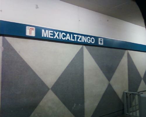
Photo: Qk-racho, CC BY-SA 3.0.
The Mexicaltzingo railway station is part of the Sistema de Tren Eléctrico Urbano in the Mexican state of Jalisco. Mexicaltzingo light rail station is situated 1 km northwest of cetac.
cetac
- Type: School
- Category: education
- Location: Guadalajara, Jalisco, Pacific Coast, Mexico, North America
- View on OpenStreetMap
Latitude
20.66042° or 20° 39′ 38″ northLongitude
-103.35186° or 103° 21′ 7″ westOpen location code
75GRMJ6X+57OpenStreetMap ID
node 4168167290OpenStreetMap feature
amenity=school
This page is based on OpenStreetMap, Wikidata, and Wikimedia Commons.
We’d love your help improving our open data sources. Thank you for contributing.
Satellite Map
Discover cetac from above in high-definition satellite imagery.
Places with the Same Name
Discover other places named “cetac”.
Notable Places Nearby
Highlights include ACORD DE MEXICO and Cuartel de Bomberos 1944.
Nearby Places
Explore places such as coyul and ESCUELA MECANICA DISEL Y GASOLINA.
Jalisco: Must-Visit Destinations
Delve into Puerto Vallarta, Tequila, Lagos de Moreno, and San Juan de los Lagos.
Curious Places to Discover
Uncover intriguing places from every corner of the globe.
About Mapcarta. Data © OpenStreetMap contributors and available under the Open Database License". Text is available under the CC BY-SA 4.0 license, except for photos, directions, and the map. Photo: Wikimedia, CC0.