Djuramossa
Djuramossa is a hamlet in Helsingborg Municipality, Scania. Djuramossa is situated nearby to the hamlet Döshults kvarn, as well as near Mjöhult.| Tap on a place to explore it |
Places of Interest
Highlights include Military Preparedness Museum and Kulla Gunnarstorp Castle.

Kulla Gunnarstorp Castle
Castle
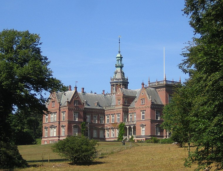
Photo: Wikimedia, CC BY-SA 3.0.
Kulla Gunnarstorp Castle is a castle in Helsingborg Municipality, Scania, in southern Sweden. Kulla Gunnarstorp is located near the Öresund between the villages Hittarp and Domsten, about 10 kilometers north of Helsingborg.
Kulla Gunnarstorp mill
Windmill

Photo: Jorchr, CC BY-SA 3.0.
The Kulla Gunnarstorp mill is a Scanian historical landmark north of Helsingborg, Sweden, in the suburb of Hittarp. It is a smock mill with a boat-shaped cap, which is unique in Scania. Kulla Gunnarstorp mill is situated 3 km south of Djuramossa.
Places in the Area
Nearby places include Hellebæk and Ålsgårde.
Hellebæk
Village

Photo: Janus Kannuberg, CC BY-SA 3.0.
Hellebæk is a town located on the coast five kilometres northwest of Helsingør, North Zealand, some 40 kilometres north of Copenhagen, Denmark. It has merged with the neighbouring community of Ålsgårde to form an urban area with a population of 5,775. Hellebæk is situated 8 km southwest of Djuramossa.
Ålsgårde
Quarter

Photo: Ramblersen, CC BY-SA 4.0.
Ålsgårde is a seaside resort and former fishing village on the north coast of Zealand, Denmark, located six kilometer northwest of Helsingør. Formerly Ålsgårde was a separate town, but today it has merged with the neighbouring town of Hellebæk into an urban area with a population of 5,775. Ålsgårde is situated 9 km southwest of Djuramossa.
Höganäs

Photo: Wikimedia, CC BY-SA 3.0.
Höganäs is a locality and the seat of Höganäs Municipality, Scania County, Sweden. Its population was 14,107 in 2010. Höganäs is nationally known for its ceramics industry, Höganäs Keramik.
Djuramossa
- Type: Hamlet
- Category: locality
- Location: Helsingborg Municipality, Scania, Götaland, Sweden, Nordic countries, Europe
- View on OpenStreetMap
Latitude
56.13005° or 56° 7′ 48″ northLongitude
12.63721° or 12° 38′ 14″ eastOpen location code
9F8J4JJP+2VOpenStreetMap ID
node 4179489091OpenStreetMap feature
place=hamlet
This page is based on OpenStreetMap, Wikidata, and Wikimedia Commons.
We’d love your help improving our open data sources. Thank you for contributing.
Satellite Map
Discover Djuramossa from above in high-definition satellite imagery.
Localities in the Area
Explore places such as Döshults kvarn and Döshult.
Notable Places Nearby
Highlights include 2.a Pjäs (Brita) and 1.a Pjäs.
Scania: Must-Visit Destinations
Delve into Malmö, Lund, Helsingborg, and Kristianstad.
Curious Hamlets to Discover
Uncover intriguing hamlets from every corner of the globe.
About Mapcarta. Data © OpenStreetMap contributors and available under the Open Database License". Text is available under the CC BY-SA 4.0 license, except for photos, directions, and the map. Photo: Ainali, CC BY-SA 3.0.