Gagenhart
Gagenhart is a peak in Ihringen, Breisgau-Hochschwarzwald, Baden-Württemberg and has an elevation of 380 metres. Gagenhart is situated nearby to the locality Korb-Weiden, as well as near Ahorn-Arten.| Tap on a place to explore it |
Places of Interest
Highlights include Totenkopf and Eichelspitzturm.
Totenkopf
Peak

Photo: Taxiarchos228, CC BY-SA 3.0.
The Totenkopf is a hill in Baden-Württemberg, Germany, forming the highest point in the Kaiserstuhl region. The hill is topped by an observation tower and a 120-m Deutsche Telekom communications tower. Wine and fruit are cultivated on its slopes.
Eichelspitzturm
Scenic viewpoint

Photo: Steffen 962, Public domain.
Eichelspitzturm is a scenic viewpoint.

Places in the Area
Nearby places include Gottenheim and Eichstetten am Kaiserstuhl.
Gottenheim
Village
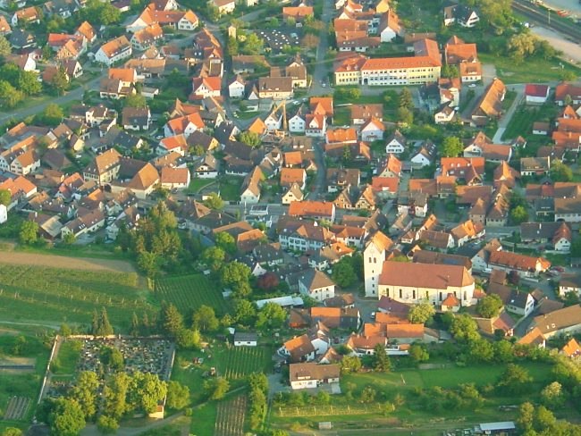
Photo: Luftfahrer, CC BY-SA 3.0.
Gottenheim is an independent village at the northern tip of the Tuniberg, 15 km west of Freiburg im Breisgau. It is located in the administrative region Breisgau-Hochschwarzwald in the federal state of Baden-Württemberg, Germany.
Eichstetten am Kaiserstuhl
Village

Photo: Luftfahrer, CC BY-SA 3.0.
Eichstetten am Kaiserstuhl is a municipality in the southwest of Baden-Württemberg in Germany near Freiburg im Breisgau.
Merdingen
Village

Photo: Mattis, Public domain.
Merdingen is a municipality in the district of Breisgau-Hochschwarzwald in Baden-Württemberg in Germany. Merdingen's main industry are vineyards. Tour de France winner Jan Ullrich, a notable resident for much of his early cycling career, has returned to the area in retirement—in part because it's one of the sunniest places in Germany.
Gagenhart
- Type: Peak with an elevation of 380 metres
- Category: landform
- Location: Ihringen, Breisgau-Hochschwarzwald, Freiburg Region, Baden-Württemberg, Germany, Central Europe, Europe
- View on OpenStreetMap
Latitude
48.0704° or 48° 4′ 14″ northLongitude
7.6862° or 7° 41′ 10″ eastElevation
380 metres (1,247 feet)Open location code
8FW93MCP+5FOpenStreetMap ID
node 419164973OpenStreetMap feature
natural=peak
This page is based on OpenStreetMap, Wikidata, and Wikimedia Commons.
We’d love your help improving our open data sources. Thank you for contributing.
Satellite Map
Discover Gagenhart from above in high-definition satellite imagery.
Places with the Same Name
Discover other places named “Gagenhart”.
Localities in the Area
Explore places such as Korb-Weiden and Ahorn-Arten.
Notable Places Nearby
Highlights include Birkensammlung and Arboretum Liliental.
Baden-Württemberg: Must-Visit Destinations
Delve into Stuttgart, Heidelberg, Karlsruhe, and Mannheim.
Curious Peaks to Discover
Uncover intriguing peaks from every corner of the globe.
About Mapcarta. Data © OpenStreetMap contributors and available under the Open Database License". Text is available under the CC BY-SA 4.0 license, except for photos, directions, and the map. Photo: Traveler100, CC BY-SA 3.0.