Station Staufener Straße
Station Staufener Straße is in Freiburg im Breisgau, Freiburg, Baden-Württemberg. Station Staufener Straße is situated nearby to the square Hans-Carl-Scherrer-Platz, as well as near the church St. Michael (Freiburg).| Tap on a place to explore it |
Places of Interest Nearby
Highlights include St. Michael (Freiburg) and Melanchtonkirche (Freiburg).

Melanchtonkirche (Freiburg)
Church

Photo: Joergens.mi, CC BY-SA 3.0.
Melanchtonkirche (Freiburg) is a church, which is situated 240 metres northwest of Station Staufener Straße.
KTS
Community center
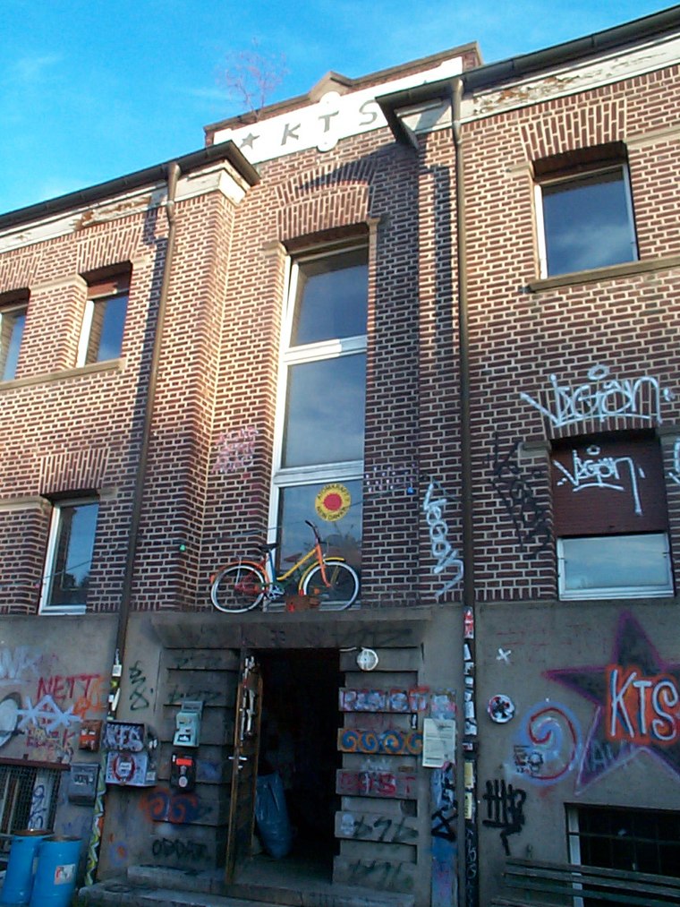
Photo: Wikimedia, CC BY-SA 3.0.
KTS is a community center, which is situated 1 km southeast of Station Staufener Straße.
Places in the Area
Nearby places include Haslach and Weingarten.
Haslach
Suburb
Haslach, incorporated into the city on 1 January 1890, is one of the Western districts of Freiburg im Breisgau. After the demerging of Weingarten the district is made up out of the boroughs 611 Haslach-Egerten, 612 Haslach-Gartenstadt, 613 Haslach-Schildacker and 614 Haslach-Haid.
Weingarten
Suburb
Weingarten is a municipal district of the city of Freiburg im Breisgau, Germany. In the north, it is separated by the river Dreisam from the district Betzenhausen, in the east beyond the rail tracks lies Haslach and in the south, separated by the Opfinger Road, the district Haslach-Haid.
Freiburg Stühlinger
Suburb
Stühlinger is a district to the west of the historic city center of Freiburg im Breisgau. In December 2013, 18,300 residents lived in the neighborhood.
Station Staufener Straße
- Type: Carsharing
- Wheelchair access: limited
- Category: transportation
- Location: Freiburg im Breisgau, Freiburg, Freiburg Region, Black Forest, Baden-Württemberg, Germany, Central Europe, Europe
- View on OpenStreetMap
Latitude
47.99097° or 47° 59′ 28″ northLongitude
7.82022° or 7° 49′ 13″ eastBrand
Grüne Flotte CarsharingOperator
Autohaus Schmid WaldkirchOpen location code
8FV9XRRC+93OpenStreetMap ID
node 4200462229OpenStreetMap feature
amenity=car_sharingOpenStreetMap attribute
wheelchair=limited
This page is based on OpenStreetMap, Wikidata, and Wikimedia Commons.
We’d love your help improving our open data sources. Thank you for contributing.
Satellite Map
Discover Station Staufener Straße from above in high-definition satellite imagery.
Notable Places Nearby
Highlights include Hans-Carl-Scherrer-Platz and Sporthalle Pestalozzi-Schule.
Nearby Places
Explore places such as Scherrerplatz and Scherrerplatz.
Black Forest: Must-Visit Destinations
Delve into Baden-Baden, Pforzheim, Villingen-Schwenningen, and Offenburg.
Curious Places to Discover
Uncover intriguing places from every corner of the globe.
About Mapcarta. Data © OpenStreetMap contributors and available under the Open Database License". Text is available under the CC BY-SA 4.0 license, except for photos, directions, and the map. Photo: Jjtkk, CC BY-SA 3.0.