O Sopas
O Sopas is a restaurant in Covilhã e Canhoso, Covilhã, Castelo Branco District. O Sopas is situated nearby to the garden Parque Refugio, as well as near the shopping center Serra Shopping.| Tap on a place to explore it |
Places of Interest Nearby
Highlights include Complexo Desportivo da Covilhã and Covilhã train station.
Complexo Desportivo da Covilhã
Athletics track
Complexo Desportivo da Covilhã is a multi-use stadium in Covilhã, Portugal. The Complexo Desportivo da Covilhã stadium holds 3,000 seats and the entire space has also infrastructure for volleyball, badminton and athletics. Complexo Desportivo da Covilhã is situated 800 metres east of O Sopas.
Covilhã train station
Railway station
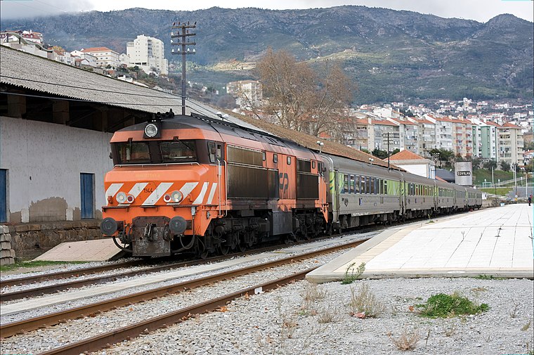
Photo: Nuno Morão, CC BY-SA 2.0.
Covilhã train station is a railway station, which is situated 1½ km northeast of O Sopas.
Capela de São Martinho (Covilhã)
Church

Photo: 1980cvl, Public domain.
Capela de São Martinho (Covilhã) is a church, which is situated 1¼ km north of O Sopas.
Places in the Area
Nearby places include Boidobra and Cantar-Galo e Vila do Carvalho.
Boidobra
Town
Boidobra is a civil parish in the municipality of Covilhã, Portugal. The population in 2011 was 3,246, in an area of 16.26 square kilometres.
Cantar-Galo e Vila do Carvalho
Town
Cantar-Galo e Vila do Carvalho is a civil parish in the municipality of Covilhã, Portugal. It was formed in 2013 by the merger of the former parishes Cantar-Galo and Vila do Carvalho. The population in 2011 was 3,974, in an area of 15.80 square kilometres. Cantar-Galo e Vila do Carvalho is situated 5 km north of O Sopas.
Penhas da Saúde
Village

Photo: Sqjaques, CC BY-SA 4.0.
Penhas da Saúde is a village in the municipality of Covilhã, Portugal. This mountain village sits right in the heart of Serra da Estrela, nestled within the scenic mountain range, at an altitude of 1,500 metres. It is primarily a winter resort. Penhas da Saúde is situated 6 km northwest of O Sopas.
O Sopas
- Type: Restaurant
- Cuisine: Portuguese and regional
- Category: food
- Location: Covilhã e Canhoso, Covilhã, Castelo Branco District, Portugal, Iberia, Europe
- View on OpenStreetMap
Latitude
40.26576° or 40° 15′ 57″ northLongitude
-7.50705° or 7° 30′ 25″ westOpen location code
8CGJ7F8V+85OpenStreetMap ID
node 4235771189OpenStreetMap feature
amenity=restaurantOpenStreetMap attribute
cuisine=portugueseOpenStreetMap attribute
cuisine=regional
This page is based on OpenStreetMap, Wikidata, and Wikimedia Commons.
We’d love your help improving our open data sources. Thank you for contributing.
Satellite Map
Discover O Sopas from above in high-definition satellite imagery.
Notable Places Nearby
Highlights include Parque Refugio and Serra Shopping.
Nearby Places
Explore places such as Escola Básica de Refúgio and Rui - Calheiro.
Portugal: Must-Visit Destinations
Delve into Lisbon, Caldas da Rainha, Porto, and Coimbra.
Curious Restaurants to Discover
Uncover intriguing restaurants from every corner of the globe.
About Mapcarta. Data © OpenStreetMap contributors and available under the Open Database License". Text is available under the CC BY-SA 4.0 license, except for photos, directions, and the map. Photo: Crazy Murdoc, CC BY-SA 3.0.