Secunda Baptest Church
Secunda Baptest Church is a church in Govan Mbeki Local Municipality, Gert Sibande District Municipality, Mpumalanga. Secunda Baptest Church is situated nearby to the lake Eendedam, as well as near Secunda Steamers.| Tap on a place to explore it |
Places in the Area
Nearby places include Secunda and Trichardt.
Secunda
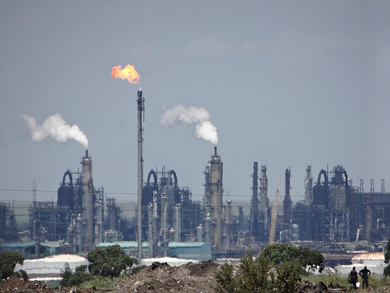
Photo: AntimatterMachine, CC BY-SA 4.0.
Secunda is a town built amidst the coalfields of the Mpumalanga province of South Africa. It was named for being the second Sasol extraction refinery producing oil from coal, after Sasolburg, some 140 kilometres to the west.
Trichardt
Suburb
Trichardt is a town on the N17 national route in Gert Sibande District Municipality in the Mpumalanga province of South Africa. The village is 34 km west of Bethal and 32 km east-south-east of Leandra, adjacent to Secunda. Trichardt is situated 4 km northeast of Secunda Baptest Church.
Secunda Baptest Church
- Type: Church
- Denomination: Baptist
- Categories: place of worship and religion
- Location: Govan Mbeki Local Municipality, Gert Sibande District Municipality, Mpumalanga, South Africa, Southern Africa, Africa
- View on OpenStreetMap
Latitude
-26.52046° or 26° 31′ 14″ southLongitude
29.20779° or 29° 12′ 28″ eastOpen location code
5G5FF6H5+R4OpenStreetMap ID
node 4277441425OpenStreetMap feature
amenity=place_of_worshipOpenStreetMap attribute
denomination=baptist
This page is based on OpenStreetMap, Wikidata, and Wikimedia Commons.
We’d love your help improving our open data sources. Thank you for contributing.
Satellite Map
Discover Secunda Baptest Church from above in high-definition satellite imagery.
Notable Places Nearby
Highlights include Eendedam and Secunda Steamers.
Nearby Places
Explore places such as PnP Minimarket and Sasol.
Mpumalanga: Must-Visit Destinations
Delve into Mbombela, Witbank, Lydenburg, and Barberton.
Curious Churches to Discover
Uncover intriguing churches from every corner of the globe.
About Mapcarta. Data © OpenStreetMap contributors and available under the Open Database License". Text is available under the CC BY-SA 4.0 license, except for photos, directions, and the map. Photo: Larsiant, Public domain.