Blüemlisegg
Blüemlisegg is a locality in Schwyz, Canton of Schwyz. Blüemlisegg is situated nearby to the locality Obere Hockern, as well as near Untere Hockern.| Tap on a place to explore it |
Places of Interest
Highlights include Grosser Mythen and Manor House Waldegg.
Grosser Mythen
Scenic viewpoint

Photo: Chris.urs-o, CC BY-SA 4.0.
The Grosser Mythen is a mountain in the Schwyzer Alps of Central Switzerland. The mountain lies in the canton of Schwyz, to the east of the town of Schwyz, and to the south of the village of Alpthal in the valley of the river Alp. Grosser Mythen is situated 3½ km north of Blüemlisegg.

Library of the Schwyz Canton
Library

Photo: Pakeha, CC BY-SA 4.0.
Library of the Schwyz Canton is situated 3 km northwest of Blüemlisegg.
Places in the Area
Nearby places include Rickenbach and Stoos.
Rickenbach
Village

Photo: Waldteufel78, CC BY-SA 3.0.
Rickenbach is a village in the municipality of Schwyz, itself in the canton of Schwyz in Switzerland. It lies some 1.5 km to the east of the town centre of Schwyz.
Stoos
Village

Photo: Nix-dorf, CC BY-SA 4.0.
Stoos is a village located in the municipality of Morschach. It is situated at 1,300 m in the Swiss canton of Schwyz and has about 100 inhabitants. It is used as a small ski resort with a cable car leading to the Fronalpstock.
Oberschönenbuch
Hamlet
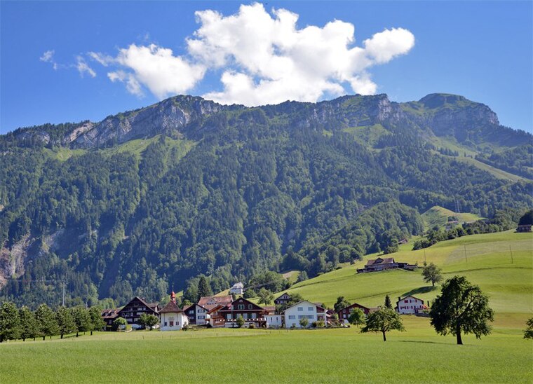
Photo: Waldteufel78, CC BY-SA 4.0.
Oberschönenbuch is a hamlet, which is situated 2½ km west of Blüemlisegg.
Blüemlisegg
- Type: Locality
- Location: Schwyz, Schwyz District, Canton of Schwyz, Central Switzerland, Switzerland, Central Europe, Europe
- View on OpenStreetMap
Latitude
46.99745° or 46° 59′ 51″ northLongitude
8.67828° or 8° 40′ 42″ eastOpen location code
8FRCXMWH+X8OpenStreetMap ID
node 4278357063OpenStreetMap feature
place=locality
This page is based on OpenStreetMap, Wikidata, and Wikimedia Commons.
We’d love your help improving our open data sources. Thank you for contributing.
Satellite Map
Discover Blüemlisegg from above in high-definition satellite imagery.
Places with the Same Name
Discover other places named “Blüemlisegg”.
Localities in the Area
Explore places such as Obere Hockern and Untere Hockern.
Notable Places Nearby
Highlights include Kapelle Aufiberg and Fotopoint ‘steilste Standseilbahn der Welt’.
Central Switzerland: Must-Visit Destinations
Delve into Lucerne, Stans, Sarnen, and Andermatt.
Curious Localities to Discover
Uncover intriguing localities from every corner of the globe.
About Mapcarta. Data © OpenStreetMap contributors and available under the Open Database License". Text is available under the CC BY-SA 4.0 license, except for photos, directions, and the map. Photo: Ikiwaner, CC BY-SA 3.0.