Buco di Ce
Buco di Ce is in Airolo, Leventina District, Ticino and has an elevation of 1,680 metres. Buco di Ce is situated nearby to the lake Laghetto dell’Alpe, as well as near the peak Pian Alto.| Tap on a place to explore it |
Places of Interest Nearby
Highlights include Airolo railway station and Lago Ritom.
Airolo railway station
Railway station

Photo: Bonzon, CC BY-SA 4.0.
Airolo railway station is a railway station in the Swiss canton of Ticino and municipality of Airolo. The station is on the original line of the Swiss Federal Railways Gotthard railway, at the southern entrance to the Gotthard Tunnel. Airolo railway station is situated 3 km west of Buco di Ce.
Lago Ritom
Reservoir

Photo: Wikimedia, CC BY-SA 4.0.
Lago Ritom is a lake in the Piora valley, Ticino, Switzerland. The natural lake is used as a reservoir by the Swiss Federal Railways to generate hydro-electric power for the Gotthard line. Lago Ritom is situated 3½ km east of Buco di Ce.
Lago di Tom
Lake
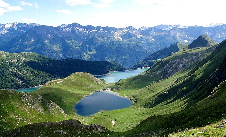
Photo: Tici23, Public domain.
Lago di Tom is a lake in the Piora Valley, in the canton of Ticino, Switzerland. Its surface area is 13 ha. It is located at an altitude of 2,021m, reaching above the tree line. Lago di Tom is situated 3½ km northeast of Buco di Ce.
Places in the Area
Nearby places include Piotta and Ambrì.
Piotta
Village

Photo: Luigi Rosa, CC BY-SA 2.0.
Piotta is a village in the municipality of Quinto in the Swiss canton of Ticino. Piotta is situated 3½ km southeast of Buco di Ce.
Ambrì
Village

Photo: Parpan05, CC BY-SA 3.0.
Ambrì is a Swiss village in the municipality of Quinto, Leventina District, Canton of Ticino. Ambrì is situated 5 km southeast of Buco di Ce.
Quinto
Village

Photo: Parpan05, CC BY-SA 3.0.
Quinto is a municipality in the district of Leventina in the canton of Ticino in Switzerland. Quinto is situated 6 km southeast of Buco di Ce.
Buco di Ce
- Type: Sign
- Categories: information and tourism
- Location: Airolo, Leventina District, Ticino, Switzerland, Central Europe, Europe
- View on OpenStreetMap
Latitude
46.53635° or 46° 32′ 11″ northLongitude
8.6453° or 8° 38′ 43″ eastElevation
1,680 metres (5,512 feet)Open location code
8FRCGJPW+G4OpenStreetMap ID
node 4306937256OpenStreetMap feature
tourism=information
This page is based on OpenStreetMap, Wikidata, and Wikimedia Commons.
We’d love your help improving our open data sources. Thank you for contributing.
Satellite Map
Discover Buco di Ce from above in high-definition satellite imagery.
Notable Places Nearby
Highlights include Cappella di Frasnè and Laghetto dell’Alpe.
Nearby Places
Explore places such as Böcc di Cé and Cé di Fuori.
Ticino: Must-Visit Destinations
Delve into Lugano, Bellinzona, Locarno, and Ascona.
Curious Places to Discover
Uncover intriguing places from every corner of the globe.
About Mapcarta. Data © OpenStreetMap contributors and available under the Open Database License". Text is available under the CC BY-SA 4.0 license, except for photos, directions, and the map. Photo: Wikimedia, CC BY-SA 3.0.