Pflegeheim Stäble
Pflegeheim Stäble is a social service facility in Neustetten, Tübingen, Baden-Württemberg which is located on Suebenstraße. Pflegeheim Stäble is situated nearby to the fire station Freiwillige Feuerwehr Neustetten, Abt. Remmingsheim, as well as near the town hall Bürgermeisteramt Neustetten.| Tap on a place to explore it |
Places of Interest Nearby
Highlights include Bronnbach and Rottenburg Cathedral.
Bronnbach
Spring

Photo: Freak-Line-Community, CC BY-SA 3.0.
The Bronnbach is a short river in Baden-Württemberg, Germany. It flows into the Neckar near Rottenburg am Neckar. The source of the Bronnbach is a strong Karst spring. Bronnbach is situated 2 km southeast of Pflegeheim Stäble.
Rottenburg Cathedral
Church
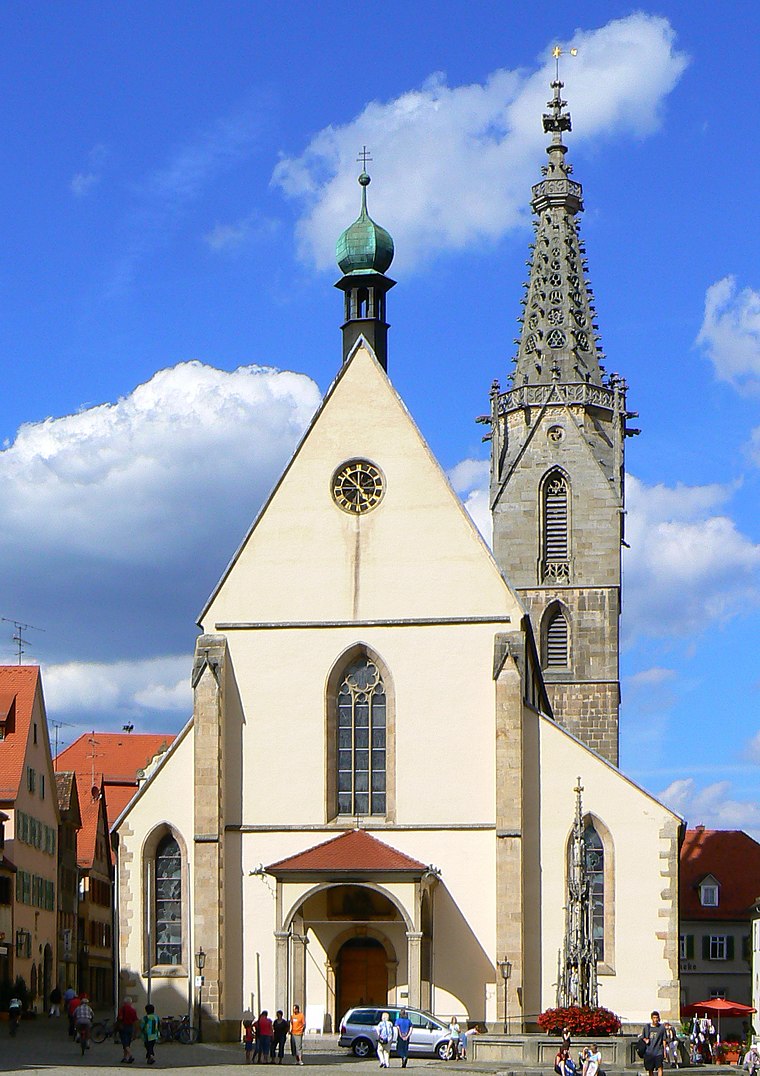
Photo: dierk schaefer, CC BY 2.0.
Rottenburg Cathedral, also known as St. Martin's Cathedral, is a Roman Catholic cathedral in Rottenburg am Neckar, Germany dedicated to Martin of Tours. It is the seat of the Diocese of Rottenburg-Stuttgart. Rottenburg Cathedral is situated 4 km east of Pflegeheim Stäble.
Weggental
Church

Photo: dierk schaefer, CC BY 2.0.
Weggental is a Roman Catholic pilgrimage church, built in the Baroque period, close to Rottenburg am Neckar. Weggental is situated 3 km east of Pflegeheim Stäble.
Places in the Area
Nearby places include Obernau and Bad Niedernau.
Obernau
Village
Obernau is a suburban district of Rottenburg am Neckar in the administrative district of Tübingen in Baden-Württemberg.
Bad Niedernau
Village
Bad Niedernau is a suburban district of Rottenburg am Neckar in the administrative district of Tübingen in Baden-Württemberg. Bad Niedernau is situated 3 km southeast of Pflegeheim Stäble.
Seebronn
Village
Seebronn is a suburban district of Rottenburg am Neckar in the administrative district of Tübingen in Baden-Württemberg. Seebronn is situated 3 km north of Pflegeheim Stäble.
Pflegeheim Stäble
- Type: Social service facility
- Address: Suebenstraße 14, Remmingsheim, Neustetten, 72149
- Location: Neustetten, Tübingen, Tübingen Region, Baden-Württemberg, Germany, Central Europe, Europe
- View on OpenStreetMap
Latitude
48.47926° or 48° 28′ 45″ northLongitude
8.88239° or 8° 52′ 57″ eastOpen location code
8FWCFVHJ+PXOpenStreetMap ID
node 4334289050OpenStreetMap feature
amenity=social_facility
This page is based on OpenStreetMap, Wikidata, and Wikimedia Commons.
We’d love your help improving our open data sources. Thank you for contributing.
Satellite Map
Discover Pflegeheim Stäble from above in high-definition satellite imagery.
Notable Places Nearby
Highlights include Freiwillige Feuerwehr Neustetten, Abt. Remmingsheim and Bürgermeisteramt Neustetten.
Nearby Places
Explore places such as Landgasthof Hecht and Remmingsheim Rathaus.
Baden-Württemberg: Must-Visit Destinations
Delve into Stuttgart, Heidelberg, Karlsruhe, and Mannheim.
Curious Social Service Facilities to Discover
Uncover intriguing social service facilities from every corner of the globe.
About Mapcarta. Data © OpenStreetMap contributors and available under the Open Database License". Text is available under the CC BY-SA 4.0 license, except for photos, directions, and the map. Photo: Traveler100, CC BY-SA 3.0.