Aiguille Saint-Phalle
Aiguille Saint-Phalle is a peak in Saint-Colomban-des-Villards, Arrondissement of Saint-Jean-de-Maurienne, Auvergne-Rhône-Alpes and has an elevation of 2,897 metres. Aiguille Saint-Phalle is situated nearby to the locality Sur Lazare, as well as near Le Vallon.| Tap on a place to explore it |
Places of Interest
Highlights include Col du Glandon and Rocher Blanc.
Col du Glandon
Mountain saddle
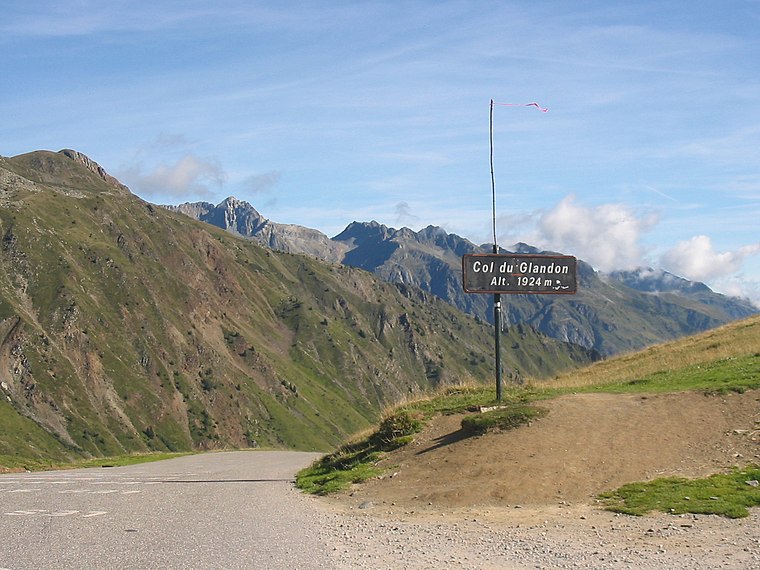
Photo: FabioDekker, CC BY-SA 3.0.
Col du Glandon is a high mountain pass in the Dauphiné Alps in Savoie, France, linking Le Bourg-d'Oisans to La Chambre. It is situated between the Belledonne, Grandes Rousses and Arvan-Villards mountain ranges, west of the Col de la Croix de Fer.


Aiguille Saint-Phalle
- Type: Peak with an elevation of 2,897 metres
- Category: landform
- Location: Saint-Colomban-des-Villards, Arrondissement of Saint-Jean-de-Maurienne, Savoie, Auvergne-Rhône-Alpes, France, Europe
- View on OpenStreetMap
Latitude
45.2445° or 45° 14′ 40″ northLongitude
6.1366° or 6° 8′ 12″ eastElevation
2,897 metres (9,505 feet)Open location code
8FQ864VP+RJOpenStreetMap ID
node 4337156065OpenStreetMap feature
natural=peak
This page is based on OpenStreetMap, Wikidata, and Wikimedia Commons.
We’d love your help improving our open data sources. Thank you for contributing.
Satellite Map
Discover Aiguille Saint-Phalle from above in high-definition satellite imagery.
Localities in the Area
Explore places such as Sur Lazare and Le Vallon.
Notable Places Nearby
Highlights include Aiguille d’Olle and Col Dulong de Rosnay.
Savoie: Must-Visit Destinations
Delve into Chambéry, Aix-les-Bains, Val-d’Isère, and Bourg-Saint-Maurice.
Curious Peaks to Discover
Uncover intriguing peaks from every corner of the globe.
About Mapcarta. Data © OpenStreetMap contributors and available under the Open Database License". Text is available under the CC BY-SA 4.0 license, except for photos, directions, and the map. Photo: Mrhugues, CC BY-SA 3.0.