Aiguille de la Combe
Aiguille de la Combe is a peak in Saint-Colomban-des-Villards, Arrondissement of Saint-Jean-de-Maurienne, Auvergne-Rhône-Alpes and has an elevation of 2,747 metres. Aiguille de la Combe is situated nearby to the locality Le Vallon, as well as near Sur Lazare.| Tap on a place to explore it |
Places of Interest
Highlights include Col du Glandon and Rocher Blanc.
Col du Glandon
Mountain saddle
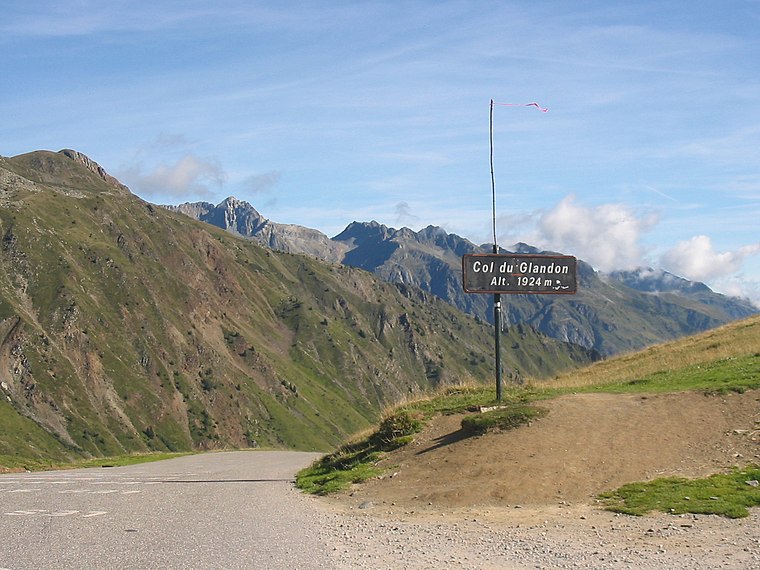
Photo: FabioDekker, CC BY-SA 3.0.
Col du Glandon is a high mountain pass in the Dauphiné Alps in Savoie, France, linking Le Bourg-d'Oisans to La Chambre. It is situated between the Belledonne, Grandes Rousses and Arvan-Villards mountain ranges, west of the Col de la Croix de Fer.


Aiguille de la Combe
- Type: Peak with an elevation of 2,747 metres
- Category: landform
- Location: Saint-Colomban-des-Villards, Arrondissement of Saint-Jean-de-Maurienne, Savoie, Auvergne-Rhône-Alpes, France, Europe
- View on OpenStreetMap
Latitude
45.2475° or 45° 14′ 51″ northLongitude
6.1453° or 6° 8′ 43″ eastElevation
2,747 metres (9,012 feet)Open location code
8FQ864XW+24OpenStreetMap ID
node 4337156068OpenStreetMap feature
natural=peak
This page is based on OpenStreetMap, Wikidata, and Wikimedia Commons.
We’d love your help improving our open data sources. Thank you for contributing.
Satellite Map
Discover Aiguille de la Combe from above in high-definition satellite imagery.
Localities in the Area
Explore places such as Le Vallon and Sur Lazare.
Notable Places Nearby
Highlights include Pointe Elisabeteh and Col de la Combe.
Savoie: Must-Visit Destinations
Delve into Chambéry, Aix-les-Bains, Val-d’Isère, and Bourg-Saint-Maurice.
Curious Peaks to Discover
Uncover intriguing peaks from every corner of the globe.
About Mapcarta. Data © OpenStreetMap contributors and available under the Open Database License". Text is available under the CC BY-SA 4.0 license, except for photos, directions, and the map. Photo: Mrhugues, CC BY-SA 3.0.