Westlich Mönchsberg
Westlich Mönchsberg is in Lichtenfels, Upper Franconia, Bavaria. Westlich Mönchsberg is situated nearby to the spring Mönchsbrunnen, as well as near the hamlet Hammer.| Tap on a place to explore it |
Places of Interest Nearby
Highlights include Schloss Schney and Schney.
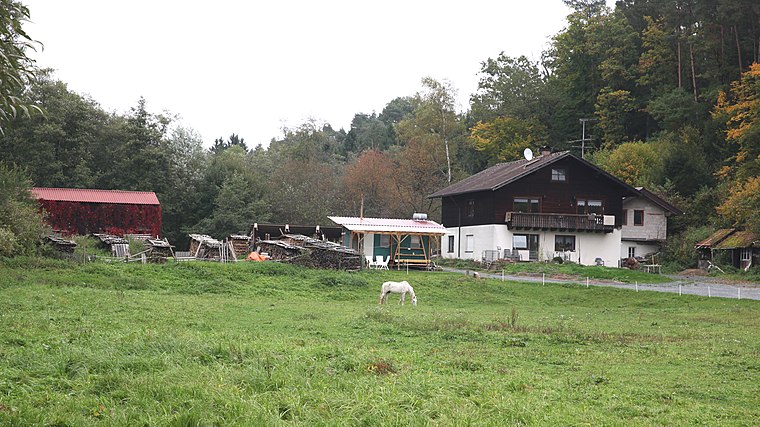
Schloss Schney
Castle

Photo: Ermell, CC BY-SA 4.0.
Schloss Schney is a castle, which is situated 2½ km southeast of Westlich Mönchsberg.
Schney
Railway stop
Schney station is a railway station in the Schney district of the town of Lichtenfels, located in the Lichtenfels district in Upper Franconia, Germany. The station is on the Eisenach–Lichtenfels line of Deutsche Bahn. Schney is situated 2 km southeast of Westlich Mönchsberg.
Lichtenfels airfield
Aerodrome

Photo: Carsten Steger, CC BY-SA 4.0.
Lichtenfels airfield is an aerodrome, which is situated 4 km south of Westlich Mönchsberg.
Places in the Area
Nearby places include Hammer and Seehof (Lichtenfels).


Westlich Mönchsberg
- Type: Sign
- Categories: information and tourism
- Location: Lichtenfels, Upper Franconia, Franconia, Bavaria, Germany, Central Europe, Europe
- View on OpenStreetMap
Latitude
50.1828° or 50° 10′ 58″ northLongitude
11.05914° or 11° 3′ 33″ eastElevation
284 metres (932 feet)Operator
Landkreis Lichtenfels, Stadt LichtenfelsNetwork
Wanderregion ObermainOpen location code
9F2H53M5+4MOpenStreetMap ID
node 4338394078OpenStreetMap feature
tourism=information
This page is based on OpenStreetMap, Wikidata, and Wikimedia Commons.
We’d love your help improving our open data sources. Thank you for contributing.
Satellite Map
Discover Westlich Mönchsberg from above in high-definition satellite imagery.
Notable Places Nearby
Highlights include Mönchsbrunnen and Mönchsberg.
Nearby Places
Explore places such as Mönchsbrunnen and Südlich Mönchsberg.
Upper Franconia: Must-Visit Destinations
Delve into Bamberg, Bayreuth, Coburg, and Hof.
Curious Places to Discover
Uncover intriguing places from every corner of the globe.
About Mapcarta. Data © OpenStreetMap contributors and available under the Open Database License". Text is available under the CC BY-SA 4.0 license, except for photos, directions, and the map. Photo: Wikimedia, CC0.