Farið
Farið is a work of art in Akureyri, Northeast. Farið is situated nearby to the health club World Class, as well as near the government office Færni- og heilsumatsnefnd Norðurlands.| Tap on a place to explore it |
Places of Interest Nearby
Highlights include Akureyrarkirkja and Akureyri Art Museum.
Akureyrarkirkja
Church

Photo: Jon Gretarsson, CC BY-SA 3.0.
Akureyrarkirkja or The Church of Akureyri is a prominent Lutheran church at Akureyri in northern Iceland. Located in the centre of the city, it was designed by Guðjón Samúelsson and completed in 1940. Akureyrarkirkja is situated 600 metres southwest of Farið.
Akureyri Art Museum
Art gallery
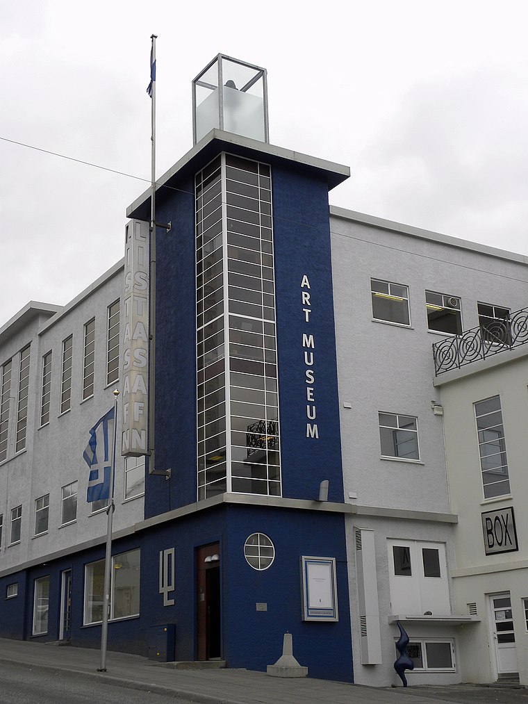
Photo: JasonParis, CC BY 2.0.
The Akureyri Art Museum was founded in 1993. The museum is located in the center of Akureyri, the second-largest city in Iceland. Originally home to a dairy, the building which houses the gallery is noted as a good example of the Bauhaus school of architecture. Akureyri Art Museum is situated 560 metres southwest of Farið.
Akureyri Botanical Garden
Garden

Photo: RenJJ, CC BY-SA 4.0.
The Akureyri Botanical Garden is a unique and significant botanical garden located in the southern part of Akureyri, a city in Northern Iceland. Situated on the west side of the inland end of the fjord Eyjafjörður, at an elevation of about 45 metres, the garden is one of the northernmost botanical gardens in the world, just 85 kilometers south of the Arctic Circle. Akureyri Botanical Garden is situated 1¼ km southwest of Farið.
Places in the Area
Nearby places include Svalbarðseyri.
Svalbarðseyri
Village

Photo: Navaro, CC BY-SA 3.0.
Svalbarðseyri is a small village in the Svalbarðsstrandarhreppur municipality, northern Iceland, which in January 2011 had 245 inhabitants. It is located on the east coast of Eyjafjörður fjord. Svalbarðseyri is situated 7 km north of Farið.
Farið
- Type: Work of art
- Artwork type: sculpture
- Category: tourism
- Location: Akureyri, Northeast, North Iceland, Iceland, Nordic countries, Europe
- View on OpenStreetMap
Latitude
65.68451° or 65° 41′ 4″ northLongitude
-18.08464° or 18° 5′ 5″ westOpen location code
9CQ3MWM8+R4OpenStreetMap ID
node 4344609323OpenStreetMap feature
tourism=artworkOpenStreetMap attribute
artwork_type=sculpture
This page is based on OpenStreetMap, Wikidata, and Wikimedia Commons.
We’d love your help improving our open data sources. Thank you for contributing.
Satellite Map
Discover Farið from above in high-definition satellite imagery.
Places with the Same Name
Discover other places named “Farið”.
Notable Places Nearby
Highlights include World Class and Færni- og heilsumatsnefnd Norðurlands.
Nearby Places
Explore places such as Sálarrannsóknarfélagið á Akureyri and Miðlun fasteignir.
North Iceland: Must-Visit Destinations
Delve into Húsavík, Mývatn, Fossholl, and Siglufjörður.
Curious Work Of Arts to Discover
Uncover intriguing work of arts from every corner of the globe.
About Mapcarta. Data © OpenStreetMap contributors and available under the Open Database License". Text is available under the CC BY-SA 4.0 license, except for photos, directions, and the map. Photo: Wikimedia, CC BY-SA 3.0.