Health&Travel Club
Health&Travel Club is a travel agency in Floridsdorf, Vienna. Health&Travel Club is situated nearby to the social service facility Pflege Floridsdorf, as well as near Joseph-Samuel-Bloch-Park.| Tap on a place to explore it |
Places of Interest Nearby
Highlights include Wien Floridsdorf railway station and St. Leopold’s Church, Donaufeld.
Wien Floridsdorf railway station
Railway station
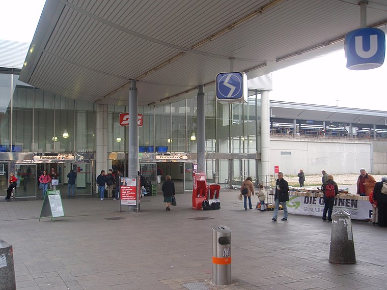
Photo: My Friend, CC BY-SA 3.0.
Wien Floridsdorf is a railway station located in the Floridsdorf district of Vienna, Austria. Opened in 1961, it is owned and operated by the Austrian Federal Railways, and is served by both regional and S-Bahn trains. Wien Floridsdorf railway station is situated 420 metres west of Health&Travel Club.
St. Leopold’s Church, Donaufeld
Church

Photo: Bwag, CC BY-SA 4.0.
Saint Leopold's Church is the Roman Catholic parish church of Donaufeld in Floridsdorf, the 21st district of Vienna, Austria. Located at Kinzerplatz, it stands at a height of 96 m, which makes it the third tallest church in Vienna. St. Leopold’s Church, Donaufeld is situated 370 metres southeast of Health&Travel Club.
Floridsdorf station
Metro station

Photo: My Friend, CC BY-SA 3.0.
Floridsdorf is a station on U6 of the Vienna U-Bahn. It is located in the Floridsdorf District, underneath Wien Floridsdorf railway station, which is also served by Vienna S-Bahn lines S1, S2, S3 and S7. It opened in 1996. Floridsdorf station is situated 380 metres west of Health&Travel Club.
Places in the Area
Nearby places include Outer East and Bruckhaufen.
Outer East

Photo: D.W., Public domain.
Outer East describes the Vienna districts Floridsdorf and Donaustadt.

Großjedlersdorf
Suburb
 Großjedlersdorf is a suburb, which is situated 2½ km north of Health&Travel Club.
Health&Travel Club
- Opening hours: Monday—Friday 9:00 AM—1:00 PM
- Type: Travel agency
- Category: shop
- Location: Floridsdorf, Vienna, Austria, Central Europe, Europe
- View on OpenStreetMap
Latitude
48.25527° or 48° 15′ 19″ northLongitude
16.40542° or 16° 24′ 20″ eastOpen location code
8FWR7C44+45OpenStreetMap ID
node 4346873502OpenStreetMap feature
shop=travel_agency
This page is based on OpenStreetMap, Wikidata, and Wikimedia Commons.
We’d love your help improving our open data sources. Thank you for contributing.
Satellite Map
Discover Health&Travel Club from above in high-definition satellite imagery.
Notable Places Nearby
Highlights include Pflege Floridsdorf and Joseph-Samuel-Bloch-Park.
Nearby Places
Explore places such as College 4 Kids and College for Kids.
Vienna: Must-Visit Destinations
Delve into Innere Stadt, Vienna International Airport, Inner East, and Hietzing.
Curious Travel Agencies to Discover
Uncover intriguing travel agencies from every corner of the globe.
About Mapcarta. Data © OpenStreetMap contributors and available under the Open Database License". Text is available under the CC BY-SA 4.0 license, except for photos, directions, and the map. Photo: Jebulon, CC0.